In the Polish mountains, there are some of the best hikes in Europe. To prove that bold statement I gathered some of the most beautiful hiking trails in Poland.
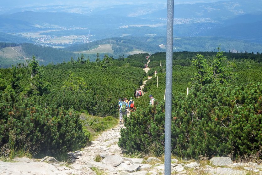
These trails are OK both for beginners and all the other mountain aficionados who wish to discover the natural beauty of Poland. There are no chains or exposure points, trails are wide, safe and well-marked. Almost all of them are circular so you don't need to climb down the same path.
If you decide to try hiking in Poland, make sure you visit at least one of those mountain ranges.
For me, those are some of the best easy hiking trails in Europe! 💙
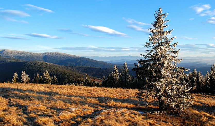
Mountains in Poland - best easy hikes
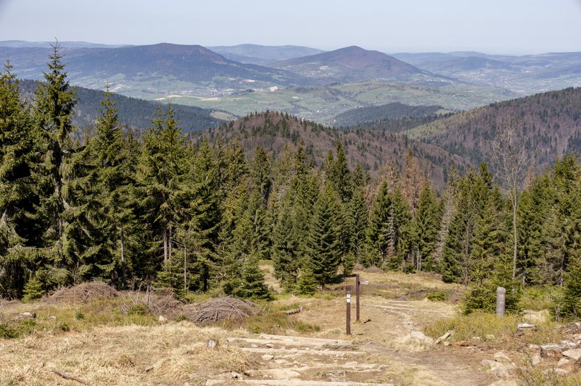
Mountain ranges in Poland
In southern Poland, there are beautiful mountains. They run along the border with Czechia, Slovakia and Ukraine.
There are 3 main mountain chains, each of which is divided into many ranges:
1. Świętokrzyskie Mountains
This mountain chain is the lowest in Poland - the highest peak is Łysica mountain and it reaches barely 613 metres.
There are so many small mountain ranges within the Świętokrzyskie chain that I'll skip mentioning them all.
What's important is the fact that within these mountains there is Swietokrzyski National Park - a beautiful nature reserve, a perfect getaway if you wish to discover some off-the-beaten-path places in Poland or relax after visiting crowded Krakow or Zakopane.
2. Carpathian Mountains
Every mountain range in the Polish Carpathian mountains is a good option for hiking near Krakow. The closest are Pieniny Mountains, Gorce Mountains and Beskidy Wyspowy Mountains - they are within a 1-2 hour drive from Krakow.
Mountain ranges which belong to the Carpathian Mountains:
⛰️ Tatra Mountains - also called the Polish Alps. The most famous mountains in Poland. They're divided into High Tatras and Western Tatras.
⛰️ Pieniny - some consider this mountain range even more beautiful than Tatras. Hiking in Pieniny National Park is a feast for the eyes.⛰️ Silesian Beskidy - we live nearby and love these mountains!
⛰️ Little Beskidy
⛰️ Makowski Beskidy
⛰️ Żywiecki Beskidy - the most beautiful of all Beskidy Mountains in Poland. There's Babia Góra National Park - yet another stunning place on the list of National Parks in Poland.
⛰️ Wyspowy Beskidy - located a stone's throw away from Krakow, the perfect option for a day trip if you're visiting this famous Polish city. Beskid Wyspowy is a low mountain range, hiking trails are nice and easy, suitable for all levels of hiking experience. And it's one of the least popular mountain ranges in Poland - there are rarely crowds on the trails.
⛰️ Gorce Mountains - a great option for a day trip from Krakow. There's Gorce National Park.
⛰️ Sądecki Beskidy
⛰️ Low Beskidy
⛰️ Bieszczady
⛰️ Sanocko-Turczańskie Mountains - I think there are not many people (even in Poland) who heard about this mountain range 😉
3. Sudety Mountains
Located in southwest Poland on the border between Poland and Czechia. Consider hiking there if you're going to visit Wrocław.
There are many mountain ranges within Sudety so I chose the most beautiful ones:
⛰️ Karkonosze⛰️ Izerskie Mountains
⛰️ Sowie Mountains (The Owl Mountains)
⛰️ Góry Stołowe (The Table Mountains)
⛰️ Śnieżnik massif
Advantages of hiking in Polish mountains
Hiking in Poland offers a wide range of advantages and benefits:
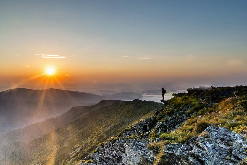
📌 Amazing scenery - mountains in Poland offer breathtaking and diverse landscapes, including rugged peaks, pristine lakes, lush valleys, and dense forests. Lots of mountain peaks offer breathtaking panoramic views.
📌 Varied terrain - the terrain in Polish mountains is great for a wide range of hiking preferences. Whether you're a beginner looking for easy trails or an experienced hiker seeking challenging routes, you'll find suitable options in the Polish mountains.
📌 Abundant trails - an extensive network of well-marked hiking trails makes it easy for hikers to explore the mountains. These trails offer a variety of lengths and difficulty levels, allowing hikers to choose routes that match their fitness and experience levels.
📌 Rich biodiversity - the mountains are home to a diverse range of flora and fauna, including unique alpine and subalpine plants. Wildlife enthusiasts can spot animals such as chamois, marmots, and various bird species during their hikes.
📌 Cultural experience - the mountainous regions in Poland, like Zakopane in Tatras or Wisła in Silesian Beskidy, have a rich cultural heritage. Visitors can explore traditional wooden architecture, participate in local customs and festivals, and sample regional cuisine.
📌 Outdoor adventure - in the Polish mountains you can try some exciting outdoor activities such as mountaineering, rock climbing, paragliding, and skiing. Also, the Tatra Mountains in Slovakia are closed in the winter but Polish Tatras are open for travellers all year round - mountains in Poland are fantastic destinations for every season.
📌 Well-preserved nature - many of the Polish mountains are protected by national parks and reserves, ensuring that the natural environment remains pristine. Hiking in these areas allows you to connect with unspoiled nature.
📌 Affordability - compared to some other international hiking destinations, visiting mountains in Poland can be relatively budget-friendly, with affordable accommodation options and reasonably priced food.
📌 Accessibility - hiking in Poland is easy to organize. Many National Parks are readily accessible from major cities like Krakow or Wrocław. Roads are well-maintained and public transportation gets better every year. If you're going to rent a car in Poland, travelling will be even easier.
📌 Safety - the well-marked trails, established infrastructure, and relatively low risk of natural disasters (compared to some other mountain ranges) contribute to the safety of hiking in Polish mountains.
OK, now let's have a look at some of the best hikes in Poland.
12 best hikes in Poland
I grouped the hiking trails according to the mountain ranges they belong to. They all offer a fantastic opportunity to connect with nature, experience diverse landscapes and enjoy outdoor activities.
Tatra Mountains - hikes from Zakopane
All the below trails are easily accessible from Zakopane.
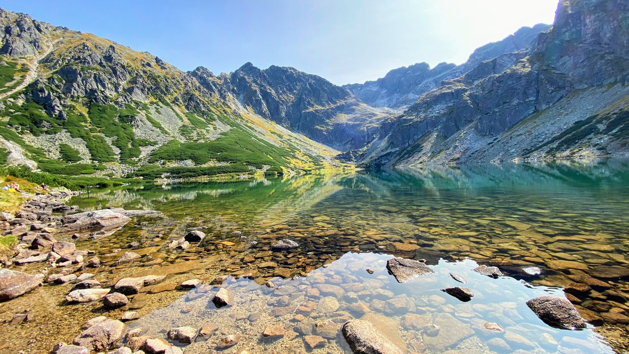
1. The Black Pond (Czarny Staw Gąsienicowy)
This trail is recommended by Jan from Popstrykane Podróże blog.
Route: Kuźnice (Zakopane) → Przełęcz Między Kopami pass → Murowaniec mountain hut → Czarny Staw Gąsienicowy → Kuźnice
Length: 13km
Time: 5-6 hours
Difficulty: medium
Height difference: 600m
Trail color: yellow, blue
Many hikers consider Tatra mountains to be one of the best places to hike in Europe. There are many fantastic trails but my favorite one is Czarny Staw Gąsienicowy (The Black Pond).
The Black Pond is one of the most popular Tatra National Park trails in the summertime. Given the relatively easy access and the uniqueness of the spot, that comes as no shock.
Nevertheless, there is a way to experience this magnificent place, while not being bothered by the crowds of tourists. The key to finding the right moment is choosing to go off-season. Anyway, no matter when you decide to go and how many people you meet on the way, I guarantee you will not be disappointed after reaching the destination.
I planned my trip to Tatra mountains for early November. There was quite some snow on the track, but still, you can manage to pass without any special equipment.
We start our hike in Kuźnice (part of Zakopane) and take the yellow trail until we reach the Przełęcz Między Kopami pass. This is about halfway up. Then you take the blue trail and continue your way up, passing the Murowaniec PTTK House and after 45 minutes we are standing eye to eye with the beauty of the Black Pond.
There is no doubt you will be amazed by how exceptionally the dark water contrasts with the whiteness of the snow covering the surrounding peaks.
The way down is the same for half the way. You can (and you should) stop at Murowaniec mountain hut for a warm soup and a quick bite to regenerate. After you reach the Przełęcz Między Kopami again you can either take the same path (yellow track) back or continue to descend along the blue trail until we come down to Kuźnice again.
The route is not very difficult and definitely worth considering if you are up for a day trip in Tatra mountains with excellent views on the way.
If you would like to stay in Tatra mountains, you can find nearby hotels in Zakopane here:
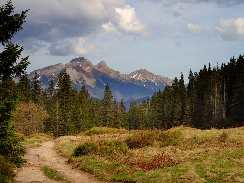
Route: Wierch Poroniec → Rusinowa Polana clearing → Gęsia Szyja peak → Rówień Waksmundzka → Psia Trawka → Toporowa Cyrhla
Length: 12km
Time: 5 hours
Difficulty: easy
Height difference: 350m
Trail color: green, red
We set off from the parking lot on Wierch Poroniec.
The beginning of the green trail is a nice wide trail. It's definitely not steep - such a mild ascend is a great warm-up on the first day of hiking. It leads partially in the forest, but in some places we get to admire stunning views of the Slovak High Tatra mountains.
After about 50 minutes of relaxed hiking, the terrain is getting even and we enter the amazing Rusinowa clearing. We get to admire the beautiful landscape of the highest mountain in Slovakia! The best one is Gerlach peak - it reaches 2654 metres.
Then we start climbing rather steep steps in the forest - we need to ascend about 280 metres. It's a bit demanding, but the view from Gęsia Szyja peak is worth the effort. At the top, we get to admire the same views we already saw, but this time the landscape is more dramatic - we're at 1465 metres.
Then the trail goes gently down. We pass Rówień Waksmundzka clearing, which is the perfect place to have a picnic. From there we can enjoy the mountainscape of Bielskie Tatras.
Then we get on the red trail leading to Toporowa Cyrhla. This trail may not be very picturesque (forest path), but it's nice and wide, and very easy to hike. Getting to the Psia Trawka trail fork takes about one hour.
We stay on the red trail and head to the highest district of Zakopane - Toporowa Cyrhla. It's a peaceful and quiet area offering a fantastic view of the Polish Tatra mountains.
If you would like to stay close to hiking trails, then Toporowa Cyrhla might be a good choice for you. You can book a lovely apartment here:
If you prefer to stay in Zakopane center, then Top Hostel would be a good choice. It's located on Krupowki street, close to the main Zakopane attractions.
If you're planning on traveling to Zakopane by train, you can look for hotels close to Zakopane railway station here:
3. Smreczyński pond in Tatra mountains
Route: Kiry, Zakopane → Hala Ornak mountain hut → Smreczyński Staw pond → Kiry, Zakopane
Length: 13.5km
Time: 3.5 hour
Difficulty: easy
Height difference: 300m
Trail color: green, black
Here we have the last route located in one of the most famous valleys in Tatra Mountains - Kościeliska Valley. It's part of the Western Tatras range. Kościeliska Valley is full of beautiful stone formations and leads along a murmuring stream.
It's easy, short and beautiful therefore it's one of the most popular Tatra National Park trails. It's perfect for hiking with kids (small ones in pram included).
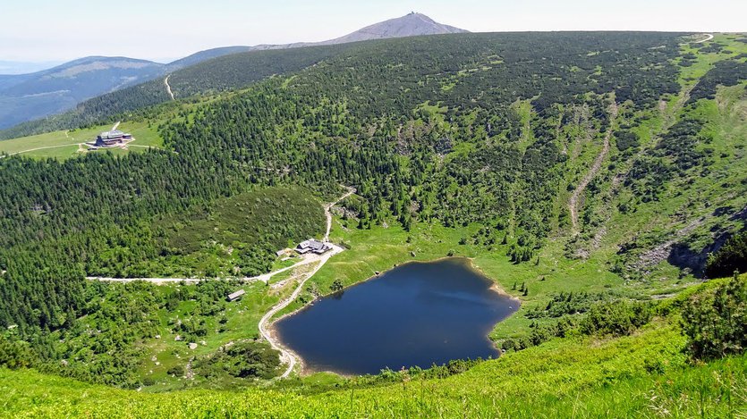
When people hear "lake in Tatra mountains" first what comes to their mind is Morskie Oko. But there's one more post-glacial pond worth visiting, also easily accessible and amazingly scenic as well! It's Smreczyński Staw pond (1227m).
It's hidden in the forest above which reign Western Tatra summits. This pond is actually very often omitted by hikers who go by to explore Western Tatras. It's also very often forgotten by tourists who visit Kościeliska valley and finish their walk in Hala Ornak mountain hut. And Smreczyński Staw is only half an hour's walk from the mountain hut! 😮
Added bonus of this route is already mentioned Kościeliska valley, which is considered the most beautiful valley in Poland.
It runs along a stream which gives a calming sound - a very relaxing experience. In the upper part of the valley there are fancy boulders, perfect for an interesting photo. In the past, this valley was used for the mining industry, but (thank heavens) now is solely for tourists. In Koscieliska valley are numerous caves, which are available for tourists to explore.
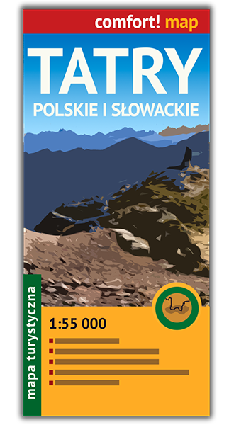
Tatra Mountains map
Having a paper map of the mountains is essential:
🗺️ Paper maps do not rely on technology or batteries, so they are always available and functional.
🗺️ Unlike electronic devices, which can run out of battery, malfunction, or lose signal in mountainous terrain, a paper map will remain reliable throughout your entire hike.
🗺️ When you're hiking in unfamiliar terrain, a paper map can help you maintain your orientation. By comparing the features on the map to your surroundings, you can confirm your location and direction.
We've been using the below Tatra Mountains map and are satisfied with it:
Other great hikes in Tatra Mountains
You may also be interested in the below hikes in Tatra Mountains:
✅ Spectacular hikes in High Tatras for hikers with middle-level experience.
✅ Hikes in Western Tatras, Slovakia.
✅ Strbske Pleso - Popradske pleso - easy and beautiful hike to High Tatras lakes.
✅ Bystra Lavka - exciting hike in High Tatras near Strbske pleso resort.
Gorce Mountains
Route: Koninki → Turbacz mountain hut → Turbacz peak → Obidowiec peak → Koninki
Length: 16km
Time: 5-6 hours
Difficulty: easy
Height difference: 700m
Trail color: blue, yellow, red, green
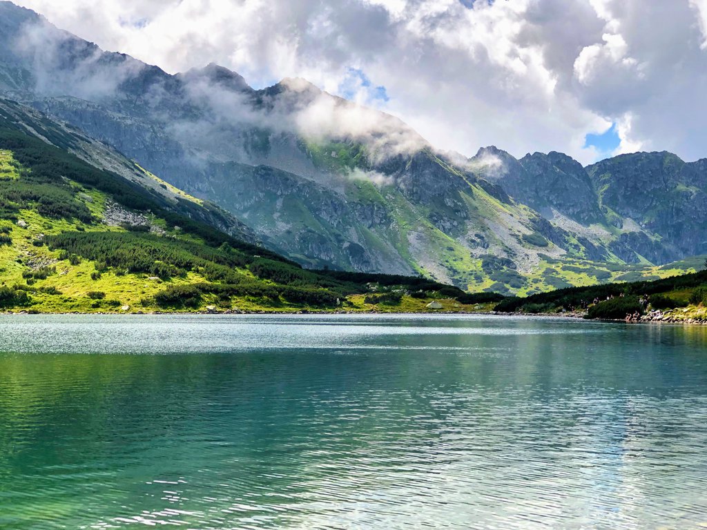
Gorce National Park is one of the best places to hike in Poland in the spring. The weather is nice and sunny, no snow left on the trails and not that many hikers yet.
It's also a fantastic option for hiking near Krakow - Gorce National Park is just about a 1.5-hour drive from the most famous Polish city.
Turbacz mountain, 1310 meters above sea level is the highest peak of Gorce mountains – one of 28 mountain ranges in Poland. The area is a national park and offers outstanding views. It is home to numerous animals – including wolves and lynxes. You’ll also see a variety of plants. If you hike there in spring you will enjoy fields covered with purple crocuses. 🙂
I recommend you to start the hike in Koninki and take the blue trail up the mountain. At first, you will walk in the forest but as you climb higher – amazing views of the surrounding mountains open up. After 7.5 kilometers of ascent, you will reach a mountain hut. There you can relax, get a drink and refresh while admiring a great view of the Tatra mountains.
You’ll have a short walk left from the mountain hut to the peak of Turbacz. Then go down along red and green trails and you’ll have more great views over Gorce and the Tatras.
The whole trip is 16.5 kilometres long, but it is not difficult. I’ve seen many families with kids of different ages hiking the trail. Take it easy, relax when you need it and enjoy. The views will be a great reward for your effort
If you would like to stay close to Gorce mountains, the perfect option would be Rabka Zdrój mountain resort. There are lots of trailheads and other tourist attractions to try when it rains.
You can find available hotels in Rabka Zdrój here:
Gorce National Park is very close to Krakow, so it's a perfect option for a Krakow day trip. Below you may look for hotels in this famous Polish city:
Silesian Beskidy Mountains
5. Skrzyczne peak
Route: Szczyrk → Pod Skrzycznem → Skrzyczne mountain hut → Pod Skrzycznem → Becyrek → Szczyrk
Length: 10km
Time: 4 hours
Difficulty: easy
Height difference: 740m
Trail color: blue, green, red
Silesian Beskidy mountains are definitely not the highest Polish mountain range, but definitely worth a hike!
Skrzyczne (1257 m) is the most popular peak in the Upper Silesia region. It attracts hikers, bikers, trail runners, skiers and paragliders.
It's best to climb this mountain on the blue trail which starts in Szczyrk on the main road.
By the way, Szczyrk mountain resort is a popular ski destination and summer mountain resort. It may be a great option for a weekend getaway and it's also one of the best day trips from Krakow - it's located just a 2-hour drive from the city.
The trail is very pleasant to hike and after just two hours of ascending, we get to see a nice panorama of the Silesian Beskidy mountains. As usual, the higher we hike, the better the landscape gets.
Top of Skrzyczne peak is a big flat area with a lookout tower. It's a great place to contemplate the beautiful mountain nature. There's also a mountain hut where they serve perfect tomato soup. 😉
We climb down to Szczyrk along the green trail. Descending takes about one hour and a half. The final part of the trail is an asphalt road.
Generally, there are lots of hiking trails in Silesian Beskids, so we have a lot of flexibility when it comes to planning the hikes. Trails are well-marked and it's practically impossible to get lost there.
If you would like to stay close to the Silesian Beskidy mountains, you can check available hotels in Szczyrk:
Pieniny Mountains
6. Trzy Korony mountain
Route: Sromowce Niżne village → Trzy Korony mountain hut → Szopka pass → Trzy Korony peak → Kosarzyska fork → Sromowce Niżne village
Length: 8km
Time: 3 hours
Difficulty: easy
Height difference: 550m
Trail color: yellow, blue, green
Some say that Pieniny National Park is the most beautiful Polish mountain range and that they are even more awe-inspiring than the Tatra Mountains. Some hikers even say that in Pieniny mountains there are the most beautiful easy hiking trails in Europe.
I like high mountains better, but I need to admit that Pieniny is a great getaway and one of the most unique places in Poland. The landscape is enriched with the picturesque Dunajec river - the terrain is actually a deep gorge.
Trails aren't demanding - a perfect option for families with children or hikers who want to warm up before bigger challenges.
The landmark of Pieniny is Trzy Korony (982 m). It's not the highest mountain, but it's definitely the most popular.
Close to the top, there is an artificial steel footpath and some steps installed to make the ascent possible. The peak of Trzy Korony is also fitted with a steel platform. The view from the top is amazing - the 360° landscape takes your breath away, especially when the weather is sunny.
Since this trail is very popular, it's advisable to hike there as early in the morning as possible - later during the day it may not be possible to contemplate nature in peace.
If you would like to stay close to the Pieniny mountains, you can check available hotels in Szczawnica - a nearby health resort. Szczawnica is a picturesque mountain resort where travelers can try many different mineral drinks of water which are recommended for a healthy lifestyle.
Bieszczady Mountains
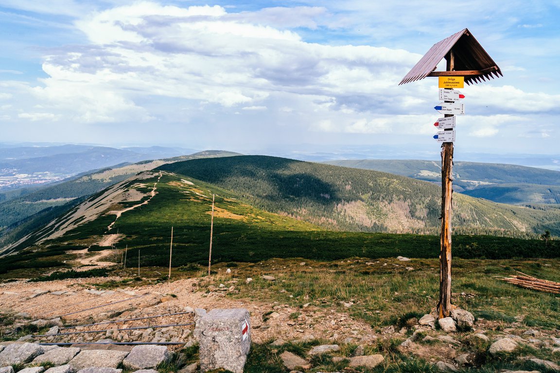
7. Tarnica peak
Route: Wołosate village → Tarnica peak → Goprowska pass → Halicz peak → Bukowska pass → Wołosate village
Length: 19km
Time: 6 hours
Difficulty: medium
Height difference: 600m
Trail color: blue, yellow, red
This route is a bit longer than the other ones, but sooo worth hiking! It includes the highest mount in Polish Bieszczady - Tarnica peak (1346 m).
Bieszczady is considered to be the wildest and most secluded Polish mountain range. Well, they are as secluded as they can get - it's easy to get to the area by car and there are already quite a few hikers, especially in the summer.
Bieszczady mountains are one of the best hiking destinations in Europe if you're looking for:
- cheap getaways
- best places to hike in Europe in May
A big advantage of this trail is that it leads through famous Bieszczady mountain pastures - picturesque vast areas typical for these mountains. They are called połoniny and are real eye candy. Plus, we get a 360° view.
The trails are wide and safe, with no avalanche risk or exposure, just a beautiful Polish landscape.
What's worth remembering is that on this route there's no mountain hut, so we need to remember to take enough food and water to hike for about 6 hours.
If you would like to stay close to Bieszczady and enjoy Polish nature in peaceful and quiet surroundings, consider choosing Wetlina village. It's a beautiful place in Bieszczady, a nice getaway perfect to contemplate the beauty of the Polish mountains.
You can find available hotels in Wetlina here:
Żywiec Beskidy Mountains
8. Rysianka alp
Route: Żabnica Skałka village → Pawlusia alp → Rysianka mountain hut → Liptowska alp mountain hut → Redykalna alp → Cukiernica clearing → Żabnica Skałka village
Length: 15.5km
Time: 5 hours
Difficulty: easy
Height difference: 550m
Trail color: green, blue, yellow, black, green, black
This route is located in Żywiec Beskidy mountains. The highest point in this route is Liptowska alp mountain hut - 1269m.
This option is so worthwhile because we pass a few clearings on our way, from which we get to admire Beskidy mountains, and when the weather is favorable, also the Tatra mountains. Rysianka clearing welcomes us to take a break and contemplate the surrounding nature. There's something very calming about this place.
There are two mountain huts on our way, both serve delicious food, so there's no need to carry a lot of snacks.
It's actually surprising that those mountain huts are so close to each other.
The explanation is, as usual, the rivalry between two countries - Liptowska alp shelter was built in the 1930s by the German organization Beskidenverein. Poles wanted to have their own mountain hut, so chose the most convenient location available and... voilà - we have Rysianka mountain hut situated 15 minutes of walk from Liptowska shelter.
Actually, Żywiec Beskids are a great option if you want to relax and breathe in some fresh air. You won't get very tired there, but for sure you will forget about everyday problems.
It might be a good idea to visit Beskidy in September when temperatures are pleasant and the mountains are rust-colored. A great thing that is!
If you would like to stay in a quiet, green area close to hiking trails, then Węgierska Górka village might be just for you. Węgierska Górka is a picturesque Polish village, perfect getaway.
You can check available options here:
9. Pilsko peak
Route: Korbielów village → Buczynka pass → Miziowa alp mountain hut → Pięciu Kopców peak → Pilsko peak → Miziowa alp mountain hut → Korbielów village
Length: 15km
Time: 5 hours
Difficulty: medium
Height difference: 900m
Trail color: blue, black, green, yellow
Pilsko is another mountain from the Żywiec Beskid range. I have to admit, besides Tatras, Żywiec Beskid is my favorite range.
This hiking option is fine for beginners, however, there are a few steep points. The majority of tourists hike up along the yellow trail and walk down the same path, but I think this option is a bit boring. The advantage of blue-black-green trails is peace and quiet - there are few hikers on those trails.
The ascend from Miziowa alp mountain hut to Pilsko is rather steep, but it's also very wide, so there's plenty of space to take a break.
The actual Pilsko peak belongs to Slovakia, so when we get to the flat top with a guidepost which suggests this is it, but it's not. 😉
However, it's a great spot for taking pictures and catching our breath. When the weather is favorable, we get to admire the scenic panorama of the Beskidy mountains and all the villages and towns in the region.
There's a narrow path among dwarf mountain pine which leads to proper mountain peak - it takes about 10 minutes to get there. On the Pilsko top, there's a cross and a small altar, but I've never heard about any mass being performed there.
If you feel it'd be great to stay close to Żywiec Beskidy mountains and enjoy beautiful nature in Poland, you may consider Kobielów village. It's a lovely mountain village with a Pilsko mountain trailhead. It's located on the Slovak border - it's a good base for hiking in Western Tatras in Slovakia.
You will find some nice hotels in Korbielów here:
10. Babia Góra peak
Route: Krowiarki pass → Babia Góra peak → Brona pass → Markowe Szczawiny mountain hut → Szkolnikowe Rozstaje → Krowiarki pass
Length: 14km
Time: 5.5 hours
Difficulty: medium
Height difference: 700m
Trail color: red, blue
I know there are already two other hiking routes in Żywiec Beskidy mountains, but I just couldn't resist mentioning Babia Gora National Park. 😉 Babia Gora mountain is called Beskidy Queen - it's the highest mountain in Poland outside the Tatra range (it reaches 1725 metres).
It's also a central point of Babia Góra National Park - a popular place for nature lovers and hiking aficionados. It may be a fine place to choose for hiking near Krakow - it's just a 1.5-hour drive from the city.
The red trail leading from Krowiarki pass is the easiest and fastest route to Babia Góra Mountain. At Krowiarki trailhead there's a big parking lot.
It gets steep at some points, but the efforts are rewarded with fantastic views which start near Sokolica peak. When the weather is nice, the Tatra mountains are also well visible.
Because of the significant height, the views from Babia Góra are more astounding than from other Żywiec peaks.
When we get closer to the top the trail gets rocky, but still, it's easy to hike and a good option for hiking with kids.
You may climb down on the same route (red trail) which is nice and easy.
Or you may choose a bit more difficult (and interesting) loop. The first part of the descent on the green/blue/red trail is a bit more tricky - on the western part of the Babia Góra mountain there is a scree (accumulation of broken rock fragments). The hike down requires some more cation and takes longer to hike but this scree fragment is short. Then the route is a nice and easy path, typical for Polish mountains in this region.
For a more detailed description of the hike to Babia Góra mountain, check out this post.
If you would like to stay close to Babia Góra National Park, then you can look for accommodation in Zawoja village.
It's a peaceful and scenic mountain village located at the foot of Babia Góra mountain. It's perfect if you're looking for a cheap getaway to enjoy nature in Poland. It's also a good base for hiking trips in Slovak Western Tatra mountains.
You will places to stay in Zawoja village here:
Stołowe Mountains
11. Szczeliniec Wielki peak
Route: Szczeliniec Wielki parking → Szczeliniec Wielki pass → mountain hut → Piekiełko gorge → Szczeliniec Wielki parking
Length: 3.5km
Time: 1 hour
Difficulty: very easy
Height difference: 150m
Trail color: yellow, red, blue
This fantastic hiking trail also belongs to the protected nature reserve - it's Stołowe Mountains National Park. It belongs to the Sudety mountains chain.
Translation: Table Mountains, Poland (let's not confuse them with Table Mountains near Cape Town).
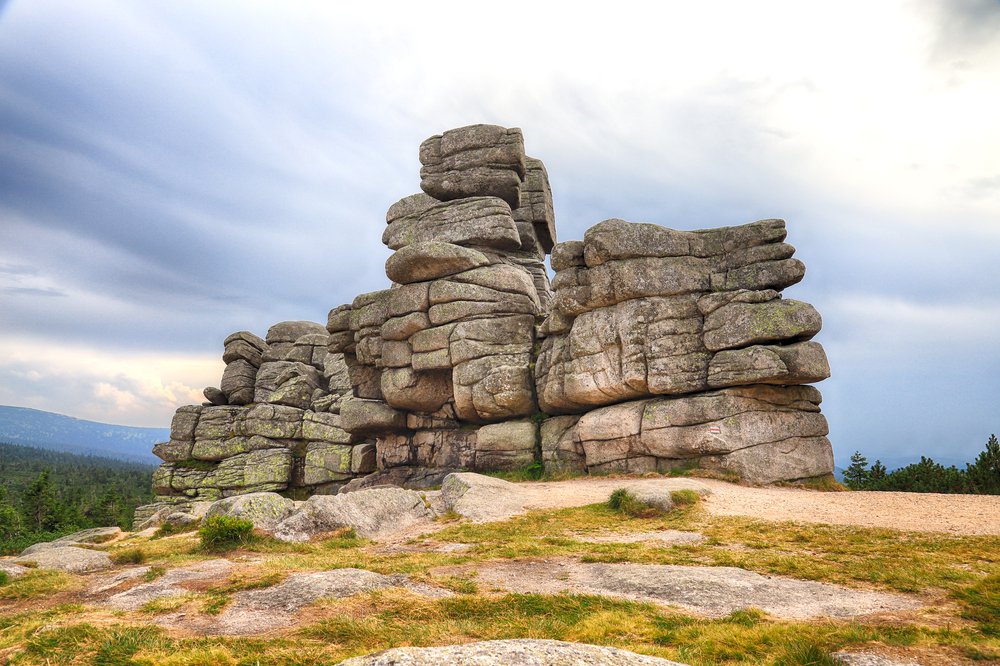
The circular route is very short, but sooo interesting! If you're planning to try hiking in Poland with kids this would be a perfect option - there are beautiful rock formations, and stony steps with chains to make hiking even easier; there are viewpoints and narrow corridors leading between massive rocks. This is one of the most unique Polish landscapes I've ever seen! Added bonus is a Szczeliniec Mountain Hut which serves delicious food.
Believe me, this route will interest even the biggest city animal. 😉
I remember hiking there with my family when I was about 6 years old and I can still recall the awesome experience of exploring winding paths hidden among enormous boulders. I was wondering if maybe some great wizard threw them about so that people can play hide-and-seek.
Szczeliniec Wielki is a small mountain (only 919m), but it's the highest peak in the Stołowe Mountains.
It's worth keeping in mind that there's a price to pay for the fact this trail is so easy and picturesque - there are crowds of tourists at the weekends and in warm months (May - September).
Side but important note: a great idea would be to visit Poland in April. Spend a few days in Wroclaw and then head into the Stołowe Mountains. No crowds, the day is long, and prices are lower.
To avoid getting stuck in traffic jams it's best to set off as early as possible, preferably on weekdays. Also, if you plan to travel Poland cheap, it's better to take with you some snacks and water, as the prices in Szczeliniec Mountain Hut are much higher than in other mountain huts in Poland.
If you would like to stay close to the Polish Table mountains, you can find available hotels here:
Karkonosze Mountains
12. Mały Staw lake
Route: Rozdroże Łomnickie parking → Polana w Karkonoszach clearing → Samotnia mountain hut → Strzecha Akademicka mountain hut → Rozdroże Łomnickie parking
Length: 3km
Time: 2.5 hour
Difficulty: easy
Height difference: 450m
Trail color: green, blue, yellow
Nice and easy route with spectacular viewpoints. Located in Karkonosze National Park Poland - one of the most unique places in Poland.
Karkonosze Mountains are part of the Sudety Mountains chain. This region is a perfect place for a Wrocław day trip.
For me, Mały Staw lake is the most beautiful place in Karkonosze National Park.
The highest point we get to is Strzecha Akademicka mountain hut at 1266 metres, so it's not very high. But on our way, we get to admire the mountain lake and post-glacial moraine (high rock formation created by glaciers). Added bonus is fancy boulders lying here and there, so typical for Karkonosze National Park and unique in this part of Europe.
Samotnia shelter (1195m) is a big mountain hut which can serve many, but in the summer it can get crowded. It's advisable to set off early in the morning, especially if you hike in high season.
Sudety mountains, especially Karkonosze National Park, is a very interesting region when it comes to rock formations. Fancy inselbergs and karst valleys will make geology lovers and Instagram influencers delighted 😉. Trails are wide and safe, so hiking there is a good idea if you travel with family.
If you feel like Karkonosze might be a good place to stay, you can check hotels in Karpacz - a mountain resort located close to hiking trails. In many places in Karpacz, you may admire the scenic view of the highest mountain in Karkonosze - Śnieżka mountain (1,603m).
Karpacz also offers a lot of other tourist attractions, so you won't get bored there even on a rainy day.
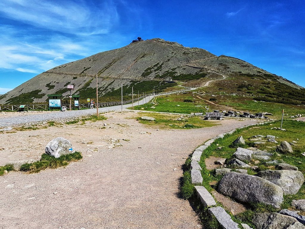
13. Śnieżka peak
Trailhead: Karpacz, Olimpijska Street parking
Length: 5.2 km
Time: 2 hours
Difficulty: easy
Height difference: 255 m
Trail color: black, red, blue
Śnieżka mountain belongs to the Karkonosze mountain range and is the highest peak in the Sudety mountains chain - it reaches 1603 m. It's also the highest mountain in Czechia (Snieżka belongs both to Poland and Czechia, how nice! 😉).
There are lots and lots of trails leading to the Śnieżka mountain but in this post, I've chosen the fastest and easiest route including the “ZBYSZEK” chairlift in Karpacz Ski Arena. Taking the chairlift will shorten the trip considerably and may be a fantastic attraction if you will be hiking in Poland with kids.
Karpacz is a lively mountain resort and it's also a popular skiing destination in Poland. There are a few parkings in the vicinity of the “ZBYSZEK” chairlift. You may check the chairlift prices here.
You start your hike to Śnieżka mountain at Kopa hill (1367 m). Reaching the mountain top takes about 1 hour. Start hiking on the black trail and soon you will cross Łomniczka stream. The views are already insane!
When you get to the trail fork of Przełęcz Pod Śnieżką mountain pass (1385 m). Take the multicolored trail leading towards Dom Śląski mountain hut (1395 m). Keep on hiking on the red trail. Many travellers consider the red trail which runs along the Czechia border as the most beautiful trail in the Sudety Mountains chain.
Hiking from the mountain hut to Śnieżka mountain takes about 40 minutes. The panorama from the mountaintop is breathtaking 🧡
To get back to Karpacz you may choose a similar route including a chairlift or climb down as per the below map:
We hiked this route and were very content about it but it's a bit long - it's 17 km of hiking and you need to start early in the morning as it takes a whole day.
If you wish to explore the amazing Karkonosze mountains, it's best to stay in Karpacz mountain resort. You may look for accommodation here:
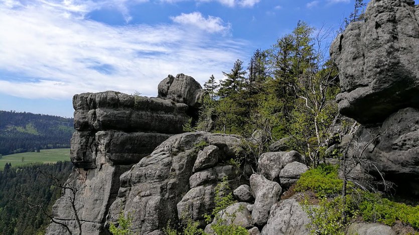
Just a quick side note: in my opinion, Sudety are the most interesting mountains in Poland because of their unique land formations and massive rocks which hikers can admire in many places on the trails.
Mountains in Poland - safety on the trail
Before we start exploring hiking trails in Poland, we need to remember about safety.
Easy as those trails may be, there's always a risk when you spend a day hiking mountains.
The majority of Polish mountains might not be very high, but, still, the weather is unpredictable.
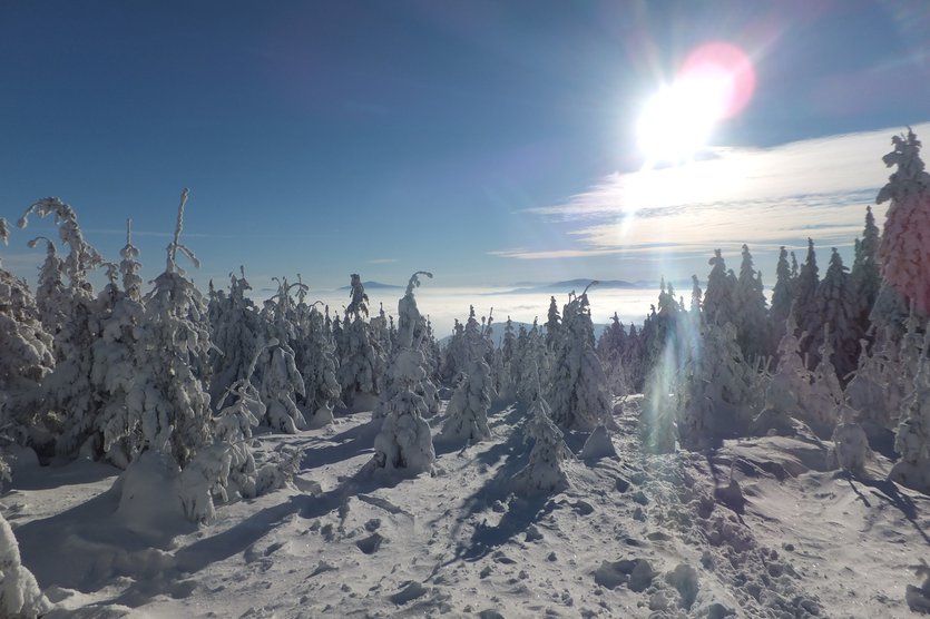
Tatra mountains are Alpine-like (they're also called the Polish Alps) and the most demanding. Hiking there can be demanding, especially in wintertime.
Here's a handful of useful links for travellers who wish to explore mountains in Poland:
- practical info on hiking in Poland
- choose proper map
- stay safe during winter hikes
- choose your backpack
- take all necessary hiking gear
- avoid these common mistakes in the mountains
- weather in the Tatra mountains is unpredictable
- rules in Polish National Parks
- dislocated shoulder - how to get better (personal story included)
Many happy hikes in Poland! 🙂 💚
If you're planning on exploring Central Europe countries, you might want to check below articles:
Travel Europe cheap - Polish natural wonders
Hiking trails in Slovakia (Western Tatras)
Amazing places to visit near Krakow Poland
Differences between Tatra National Park in Poland and Slovakia


