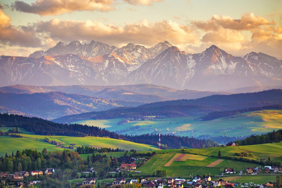
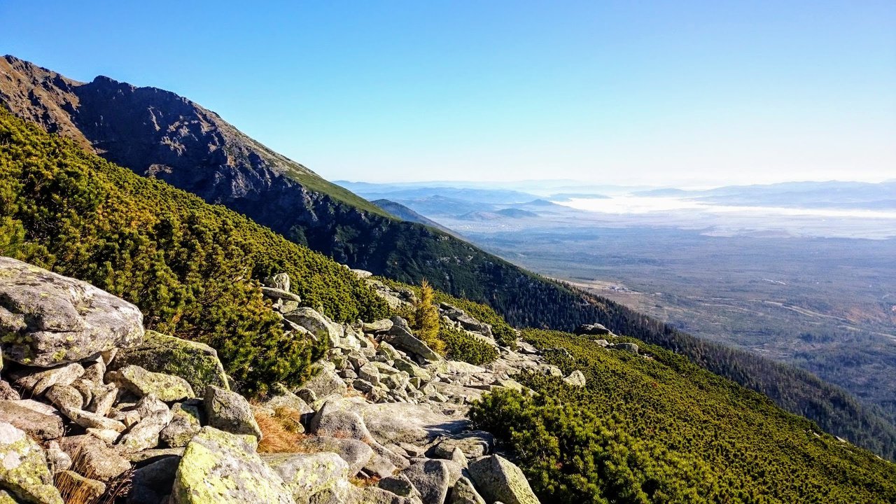
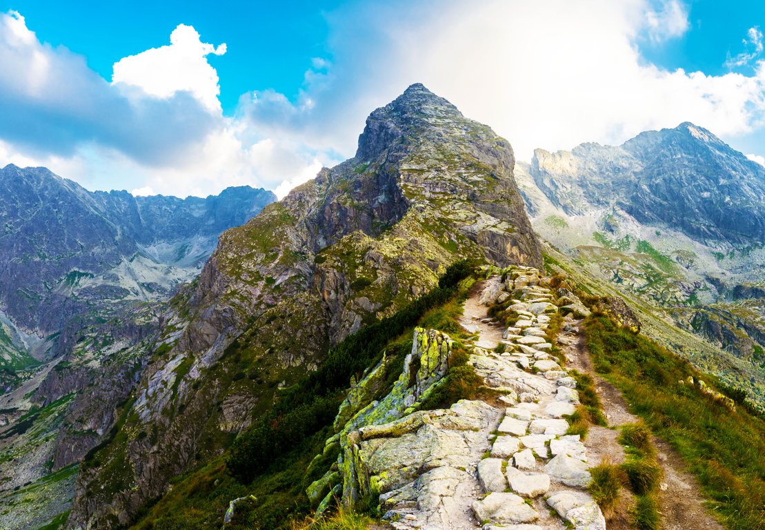
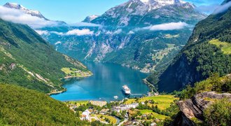
When we think about hiking in Europe, first what comes to our minds are the Alps. But there are other Alpine-like spectacular mountains in central Europe - the High Tatras.
Divided between Poland and Slovakia, they are the highest mountains in this part of Europe.
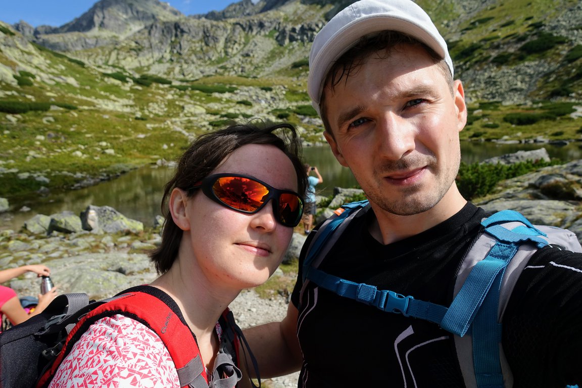
For me, hiking in High Tatras is one of the best adventures in Poland and Slovakia.
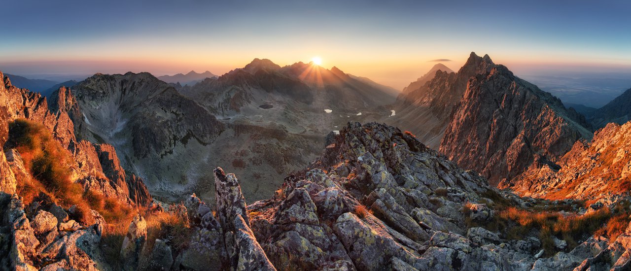
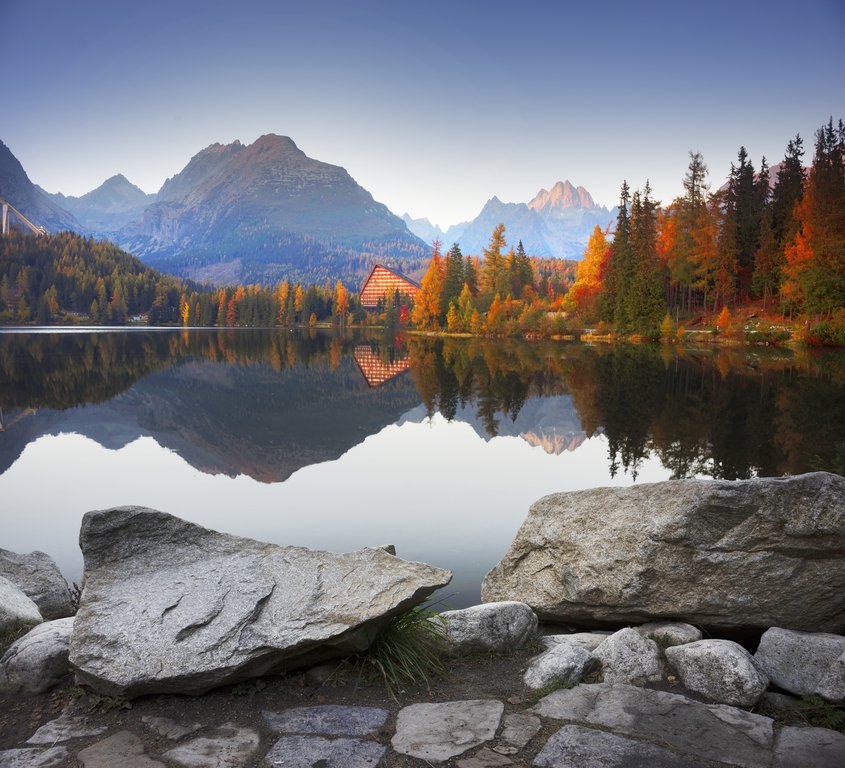
Sunrise panorama mountain autumn landscape of Slovakia Tatra mountains © TTstudio / Adobe Stock
The additional advantage of this European mountain region is low prices - Poland and Slovakia are one of the cheapest places to travel in Europe.
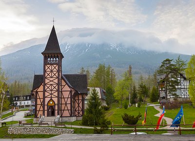
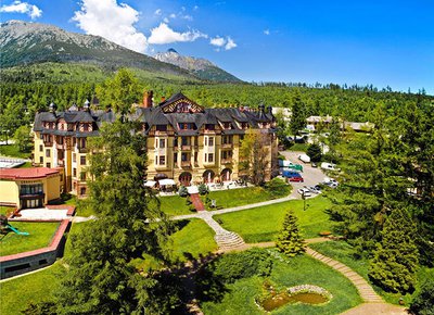
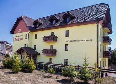
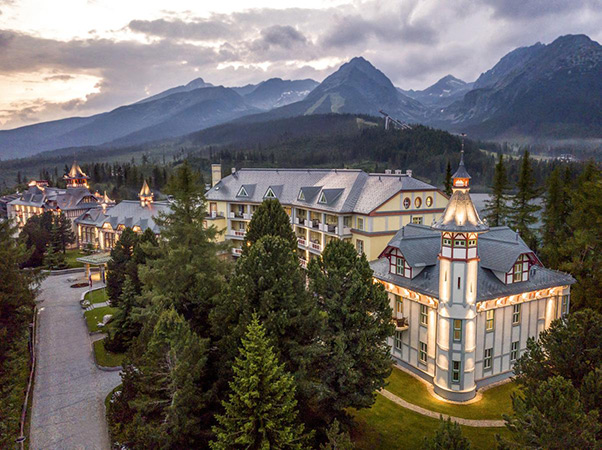
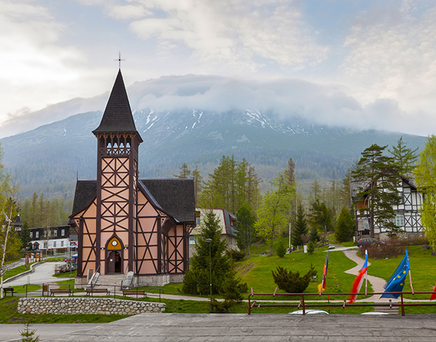
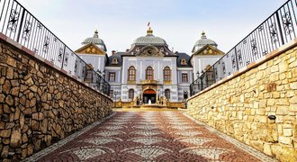
If you would like to stay in this amazing region, have a look at the most stunning Tatra Mountains resorts.
Now let's have a look at the most beautiful High Tatras hiking trails. I dare to say that because of their beauty and exciting elements, some of them are the best hikes in Europe.
When I was preparing this list I took into consideration not only the breathtaking views from the mountain top but also additional elements of the trails which add to their beauty and make the hike even more interesting.
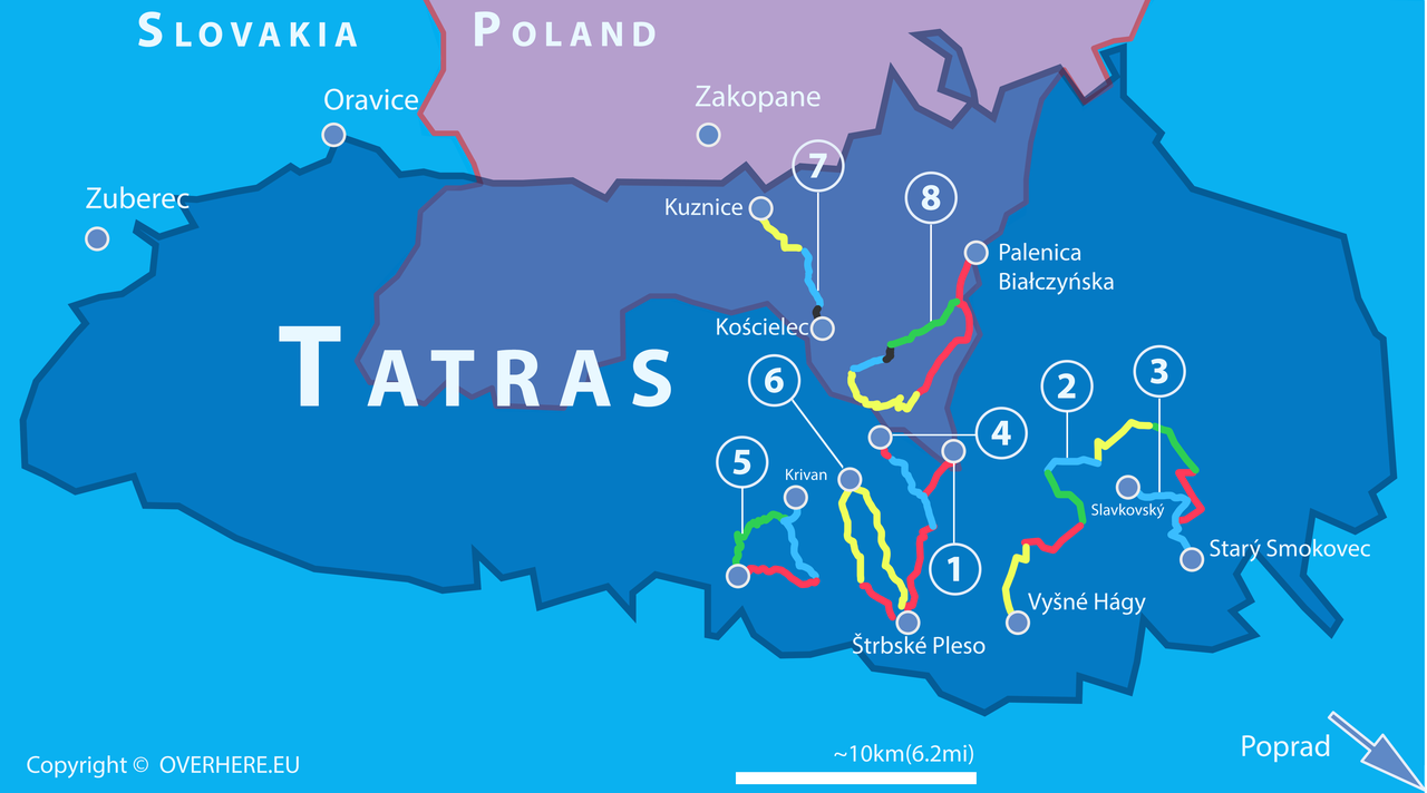
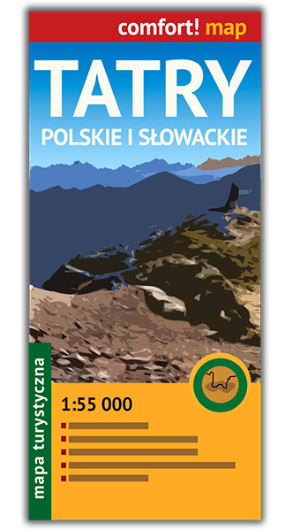
Even though there is an overview map we always recommend buying a paper hiking map of Polish & Slovak Tatras.
High Tatras hiking
 Don't miss other valuable Tatra Mountains articles
Make sure you read all helpful articles. You find them grouped them into three categories, Basic, Routes & Maps and Advanced.
Check also 11 best things to do in Slovakia.
A few quick facts about the High Tatras
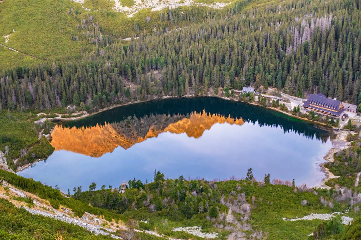
Czarny Staw Gąsienicowy, High Tatras Poland
Here are several facts which are good to know:
✅ High Tatras are part of the Carpathian Mountains - a massive range going through southern Poland, Slovakia and Ukraine.
✅ They are protected as Tatra National Park.
✅ There are several differences between Tatra National Park Poland and Slovakia.
✅ The highest mountain in Poland is Rysy (2499m).
✅ The highest mountain in Slovakia is Gerlachovský štít - 2654m (Slovakia has higher peaks than Poland).
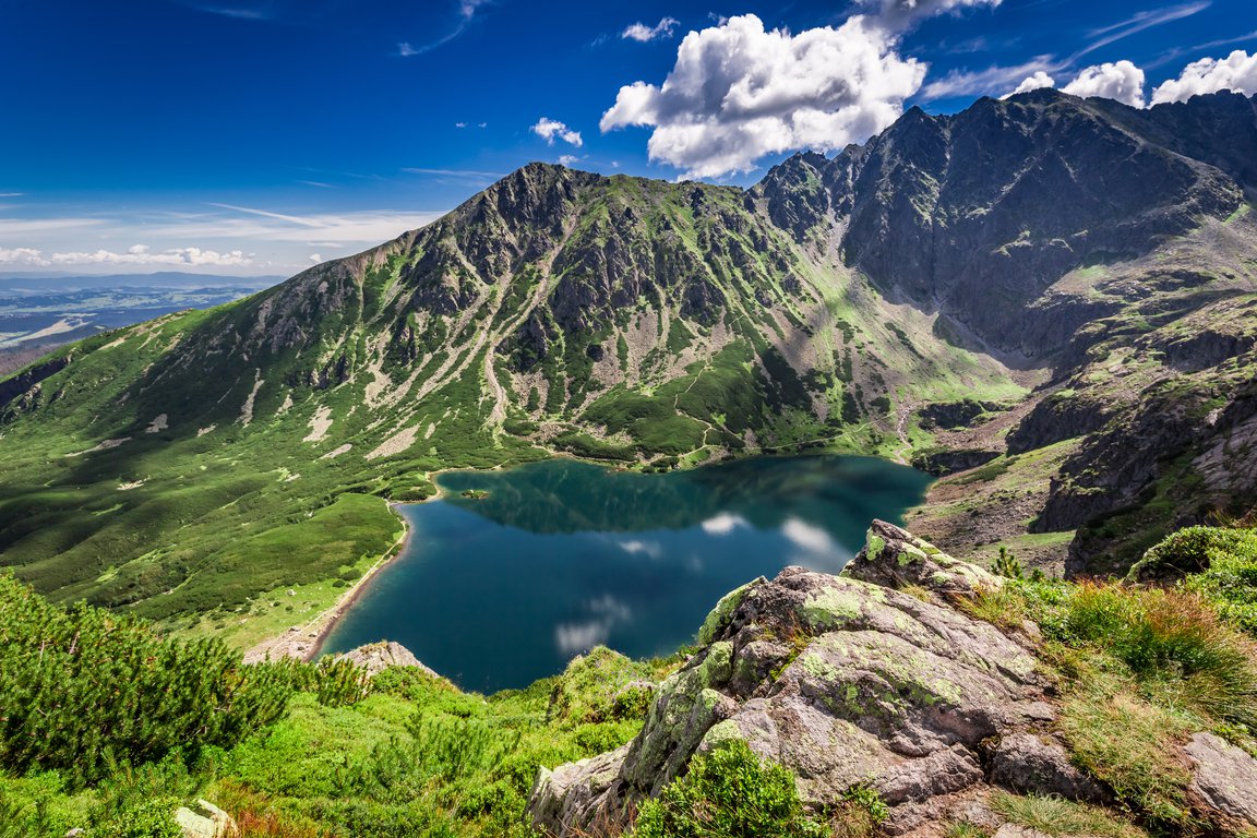
✅ In the High Tatras, there is the deepest Tatra lake - Wielki Staw. It is 79.3m deep and is located in the Valley of the Five Lakes.
✅ Entry to Tatra National Park in Poland is paid. You can either pay with cash or a card in stands at the trailheads or buy your tickets in advance here.
✅ Entry to Tatra National Park in Slovakia is free of charge.
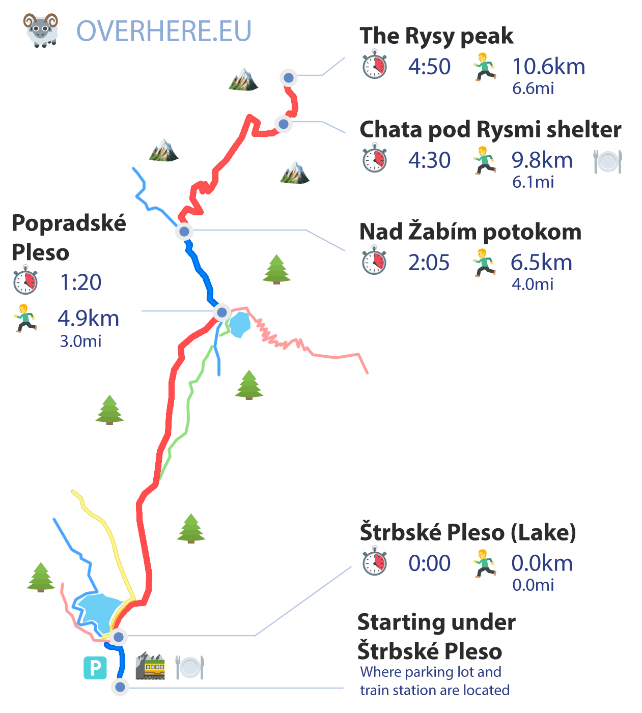
1. Rysy peak from Štrbské Pleso
The view on the Morskie Oko from Rysy peak © slavkob / Adobe Stock
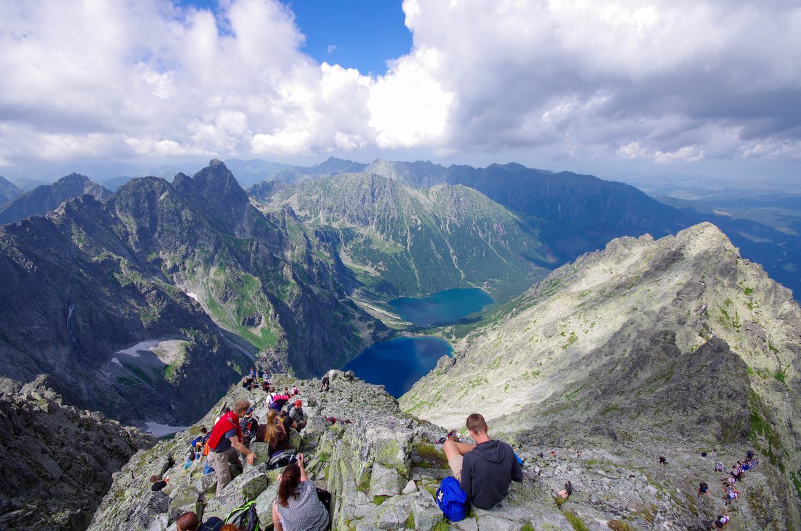
Rysy peak is one of the most popular High Tatras hiking trails. In fact, many hikers consider it one of the best mountain hikes in Europe. The mountain is split between two countries. It is the highest mountain in Poland (it reaches 2499m) and can be climbed from Poland or Slovakia.
Rysy is a mountain massif which consists of 3 peaks, the highest of which reaches 2503m and belongs to Slovakia.
Panorama from Rysy mountain is 360 degrees and on a sunny day, we get to admire almost 100 of Tatra peaks and 12 lakes. The climb is worth the effort.
This section describes the main route from Slovakia to the summit of Rysy. We can see below the statistics of the route.
Please note it is just a one-way route. It is mandatory to get back into our residence/accommodation before nightfall. Details about return options are at the bottom of this section.
|
|
Length: (only one-way) | 7.15mi (11.5km) |
|
|
Elevation: (only one-way) | 4593ft (1400m) |
|
|
Time: (only one-way) | 6:0 |
|
|
Beauty:
|
9 / 10 |
|
|
Difficulty:
|
5 / 10 |
Get a paper hiking map of Poland & Slovak Tatra.
If you are looking for a route description from Poland (Morskie Oko parking) you can find it here.
The trail in Slovakia is almost as long as the Polish trail and there is a lot of height difference to hike. It is necessary to be fit to climb Rysy.
However, the Slovak trail to Rysy Mountain is technically easier and when the weather is nice, it can be hiked even by inexperienced hikers.
We start our hike in one of the most beautiful Tatra Mountains resorts - Štrbské Pleso.
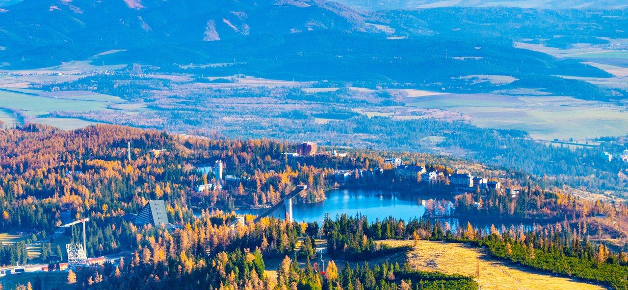
Strbskie Pleso seen from Predne Solisko mountain
We head to the trail fork (it is the upper part of the resort on the main asphalt road).
We enter the red trail and in about 1 hour we get to another famous Slovak Tatra lake - Popradské Pleso (1500m). On our way, we can also choose a bit shorter green trail but it is not as picturesque as the red parallel path.
So far the path is nice and easy. In Popradské Pleso there is a mountain hotel with a restaurant located over a picturesque lake.
Poprad lake in High Tatras mountains
We choose the blue trail. It is still an easy hike and in 40 minutes we get to a trail fork - Nad Žabím Potokom (1620m). We choose the red trail which will lead us directly to Rysy peak.
The views get better with every step. Also, the trail gets steeper and brittle, which can be a nuisance especially when climbing down.
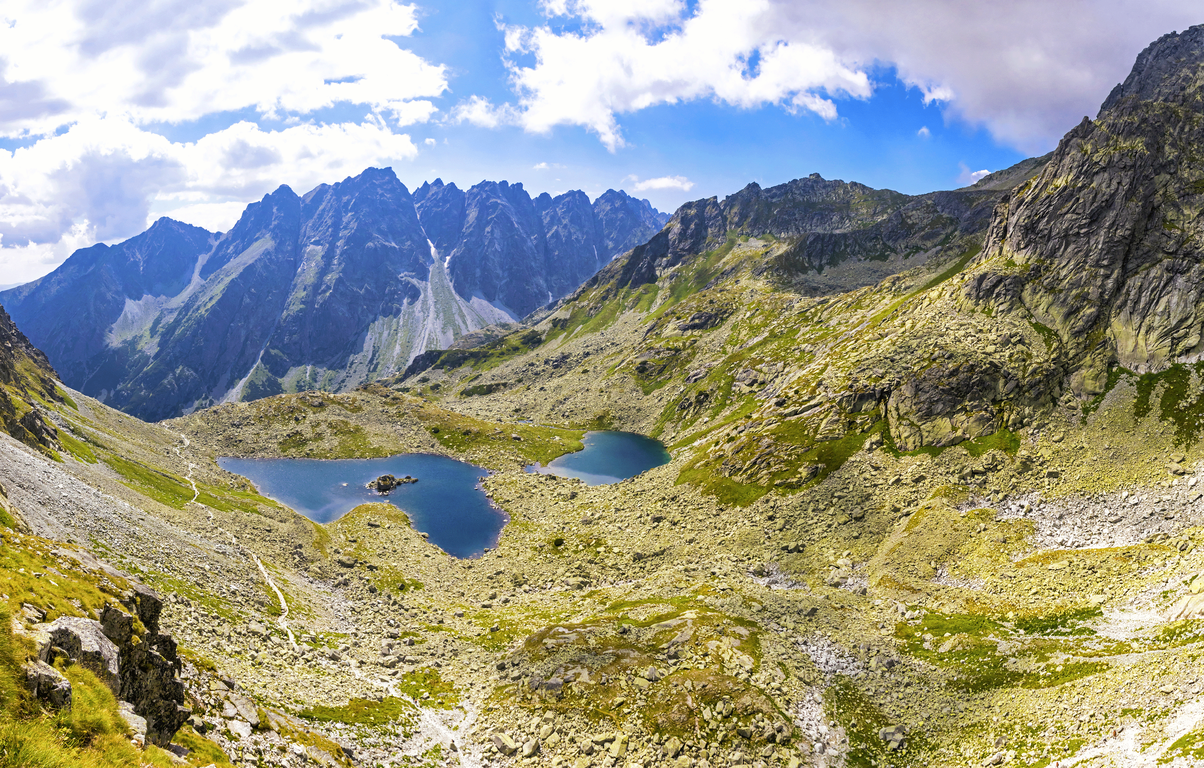
Zabie lakes (Slovak: Zabie plesa, Polish: Zabie Stawy) © katatonia / Adobe Stock
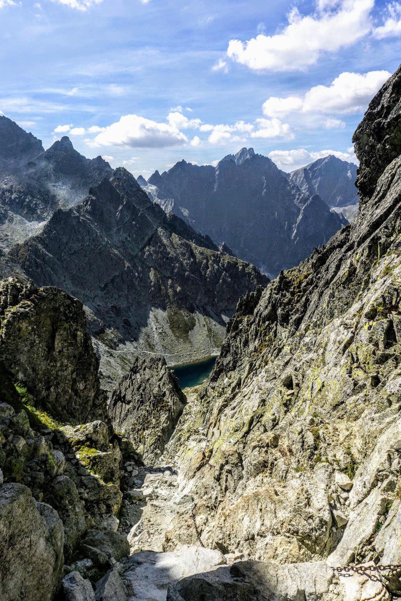
In about 1 hour we get to a spectacular Dolina Žabích Plies Valley. There are 3 postglacial lakes which add even more beauty to this amazing place.
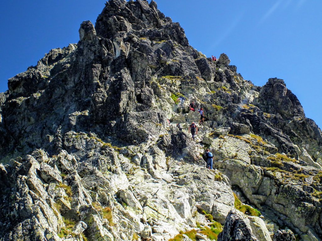
After we pass the valley, the trail gets steep and we see a few ladders and chains which make the hike more secure. Actually, this is the only spot which can speed our heart rate with excitement.
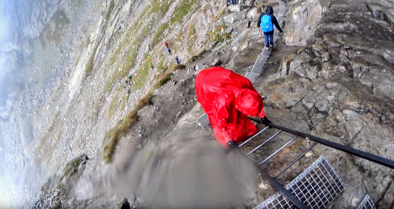
The rocky obstacles are not difficult to pass when they are dry. However, all those chains and ladders come in handy when it is raining.
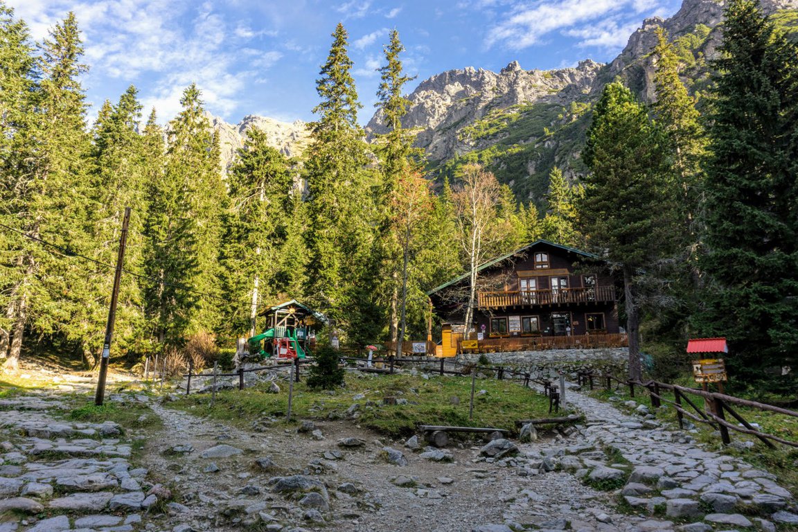
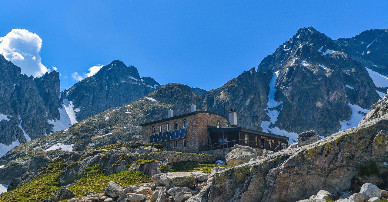
Soon we get to Chata pod Rysmi mountain hut (2250m). It is the highest-located shelter in the Tatra mountains. It is open in the same months as trails in Slovak Tatras - June 16th to October 31st.
It is famous for its characteristic outdoor toilet and the fact that the mountain hut keeps getting destroyed by avalanches.
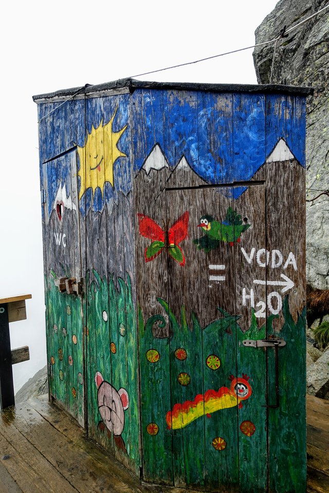
Left picture, the WC. Right the signpost and the hut. © udmurd / Adobe Stock
The mountain hut serves food and refreshments but is often crowded, so there is a high possibility we will not get any lunch there.
We set off for our final ascend - getting to Rysy Peak should take us about 50 minutes.
At first, the trail is a comfortable stony pavement which leads us to Váha Pass (2337m). This spot is a perfect place to take memorable photos - the view is astounding!
For a few moments, the path remains rather mild and pleasant to hike. The final part of the trail gets steeper and rocky but still technically easy to climb.
Rysy Mountain welcomes us with a breathtaking view of High Tatras. Let's remember to climb all three peaks of the Rysy massif (they are very close to each other).
The peak of the Rysy © kabat / Adobe Stock
We have two options to climb down:
- easier - hike the same way
- more difficult - descend to Morskie Oko lake in Poland
For summary we put together the entire route onto the timeline:
Štrbské Pleso (parking lot/train station)
We start from parking or station heading towards the lake nearby.
Distance: 0
Time: 0:00
Altitude: 4356ft (1328m)
Štrbské Pleso (lake)
After 10 minutes since leaving our car we get to be under the lake from where will be taking red trail toward Popradské pleso.
Distance: 0.3mi (0.5km)
Time: 0:11
Altitude: 4432ft (1351m)
Popradské Pleso
Once we arrived at Popradské Pleso we will follow blue trail leading north.
Distance: 3.5mi (5.6km)
Time: 1:36
Altitude: 4921ft (1500m)
Nad Žabím potokom
We have to stay alerted to not miss the red trail. We should see it relatively soon also leading north.
Distance: 4.3mi (7km)
Time: 2:16
Altitude: 5314ft (1620m)
Chata pod Rysmi (Hut under Rysy)
We hike red trail until we see the tiny hut where we can rest for a while and refill before Rysy summit.
Distance: 6.4mi (10.3km)
Time: 4:16
Altitude: 7381ft (2250m)
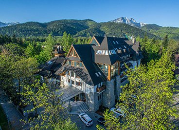
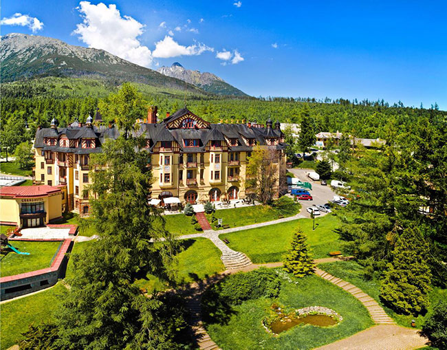
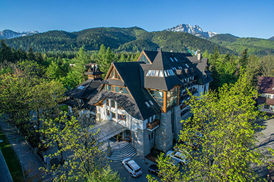
Stay in Štrbske Pleso
The closest settlement to the mountains, modern, with high standard and beautiful
The best location for hikers! To begin our hikes all we need is to walk out of our hotel building. We can walk to Rysy, Krivan and many the most famous locations right from here. It is the most convenient way if our main priority is time.

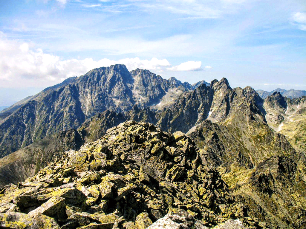
2. Východná Vysoká from Vysoké Tatry - multi-day hike
View from Vychodna Vysoka © TTstudio / Adobe Stock
This is a three-day option, one of the most exciting hiking trails in High Tatras.
The below routes are flexible, as there are several mountain huts on the way. If you feel that a proposed route is too long or short, it can be easily adjusted to your preferences.
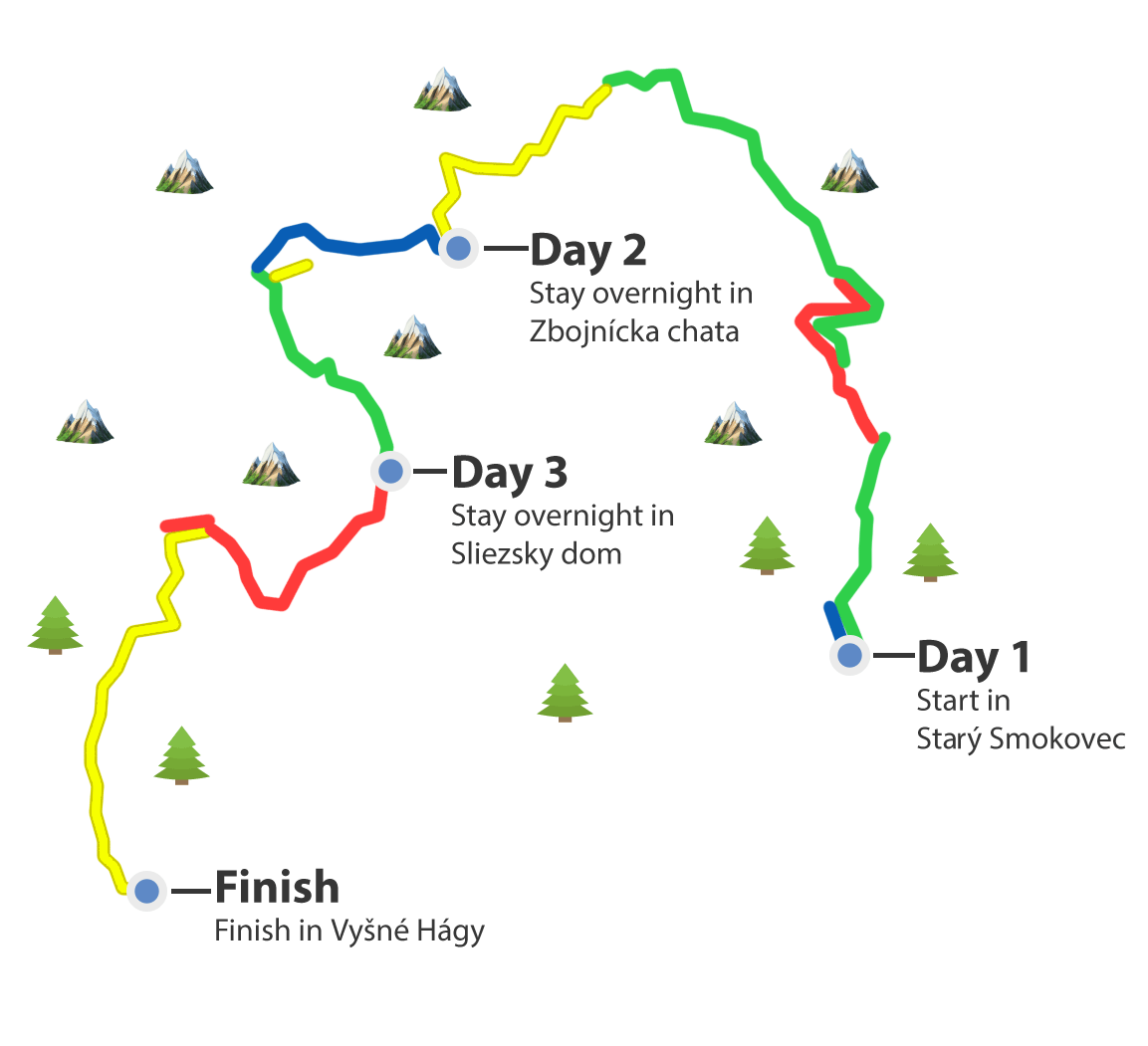
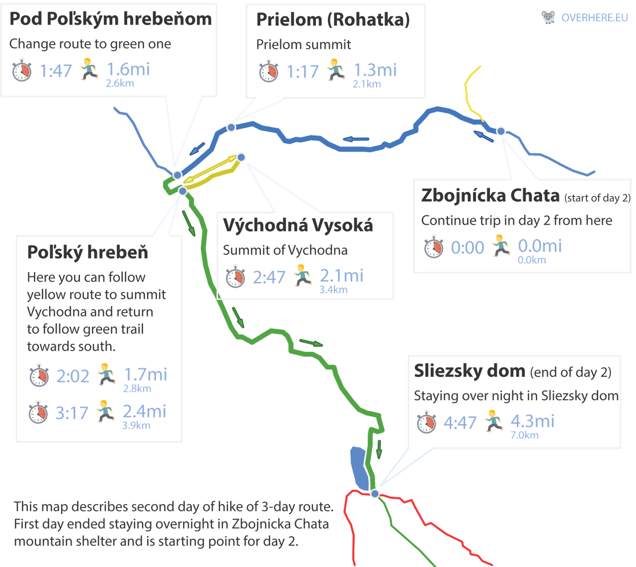
Below there is a map of our 3-day hike for review. We belive clear understanding is the key to safe and happy trips.
Gat a paper hiking map of Poland & Slovak Tatra.
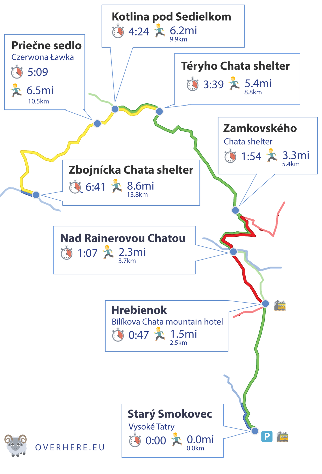
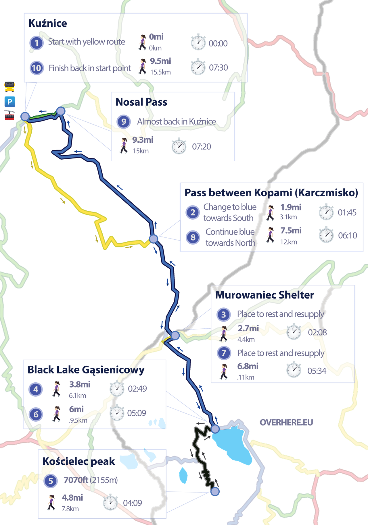
Day 1 - Going to Zbojnícka chata
This section describes the route from Stary Smokovec to the Zbojnicka chata. It is the first day of a 3-day hike.
We love multiday walks because we can enjoy the wonders of nature non-stop without checking back to the town every evening. We can disconnect from everyday life and sink into the silent rocks and whistling wind of the mountains.
|
|
Length: (only one-way) | 8.7mi (14km) |
|
|
Elevation: (only one-way) | 5413ft (1650m) |
|
|
Time: (only one-way) | 8:0 |
|
|
Beauty:
|
8 / 10 |
|
|
Difficulty:
|
8 / 10 |
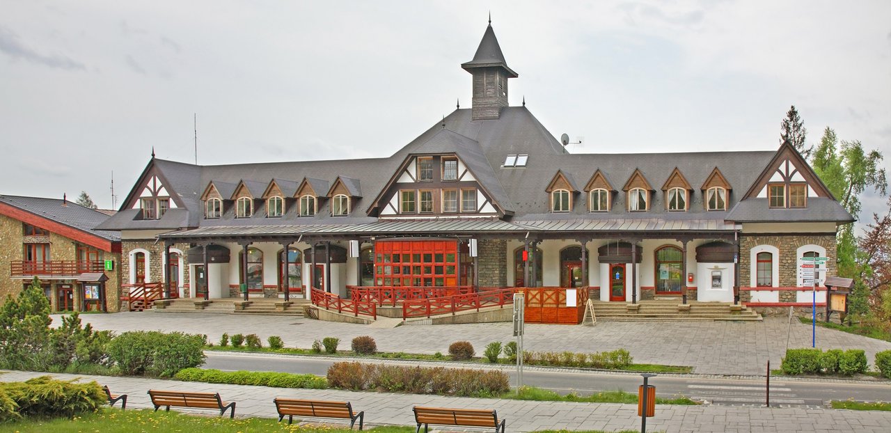
Stary-Smokovec © Andrey Shevchenko / Adobe Stock
We start our hike in Smokovec-Vysoké Tatry mountain village. At the beginning the trail is multicoloured but soon we get to the trail fork where we follow the green trail.
A nice and pleasant forest path leads us to the Hrebienok trail fork (1285m) near Bilíkova Chata mountain hotel. It is possible to book a room there. In Bilíkova Chata there is also a restaurant.
The green trail to Hrebienok . © lusiolad / Adobe Stock
We continue our trip hiking on the red trail. The view gets more beautiful with every minute. In 20 minutes we arrive at another trail fork - Nad Rainerovou Chatou (1323m).
There is a small mountain shelter nearby - Rainerova Chata. It is a nice rest stop but no food or accommodation is provided in this small mountain hut.
We start hiking on the green/red trail. It is an easy path to hike.
We cross a stream and soon get to another trail fork - Rázcestie pri Zamkovského chate (1475m). We choose the green trail and after a few moments, we arrive at another mountain hut - Zamkovského chata.
As we can see High Tatras huts are very frequent in this area 🙂
Zamkovského Chata mountain shelter offers food and accommodation. Contact details: +421 905 554 471 / +421 902 266 115.
After a break, we continue our hike on the green trail. We head to another mountain hut - Téryho Chata (2015m).
After about half an hour we get to admire the astounding view of High Tatras. The trail is still technically easy to hike but is steep - we need to do about 600m of height difference.
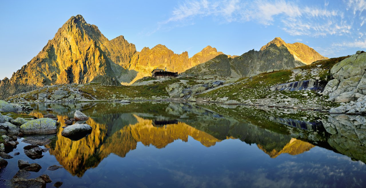
Téryho Chata © grzegorz_pakula / Adobe Stock
Téryho Chata is located high in the mountains and offers the best view from all the other mountain shelters we passed. Unlike Chata pod Rysmi, this mountain shelter is open all year round.
If we are already tired, we can stay in Téryho Chata. There are 24 beds available in 3 bedrooms. It is necessary to have our own sleeping bag, as only blankets are provided. There are washrooms but no warm water is available.
Contact details for Téryho Chata cottage:
Mobile number: +421 949 650 315
E-mail: [email protected]
After taking and break in the mountain hut we set off on a final part of today's hike.
Spišské lakes with Prostredny Hrot peak © matkovci / Adobe Stock
On our way, we get to admire not only the majestic panorama of High Tatras peaks - there are beautiful Spišské lakes. The trail runs close to Prostredné Spišské Pleso Lake - a spectacular spot!
In 40 minutes we arrive at a trail fork Kotlina pod Sedielkom (2135m). There we choose the yellow-marked path and head towards our final mountain hut - Zbojnícka Chata (1960m).
The yellow trail is the most exciting part of this route - there is a famous Priečne Sedlo (Czerwona Ławka) Pass.
This is a difficult part. Many consider it the most difficult trail in Slovak Tatras.
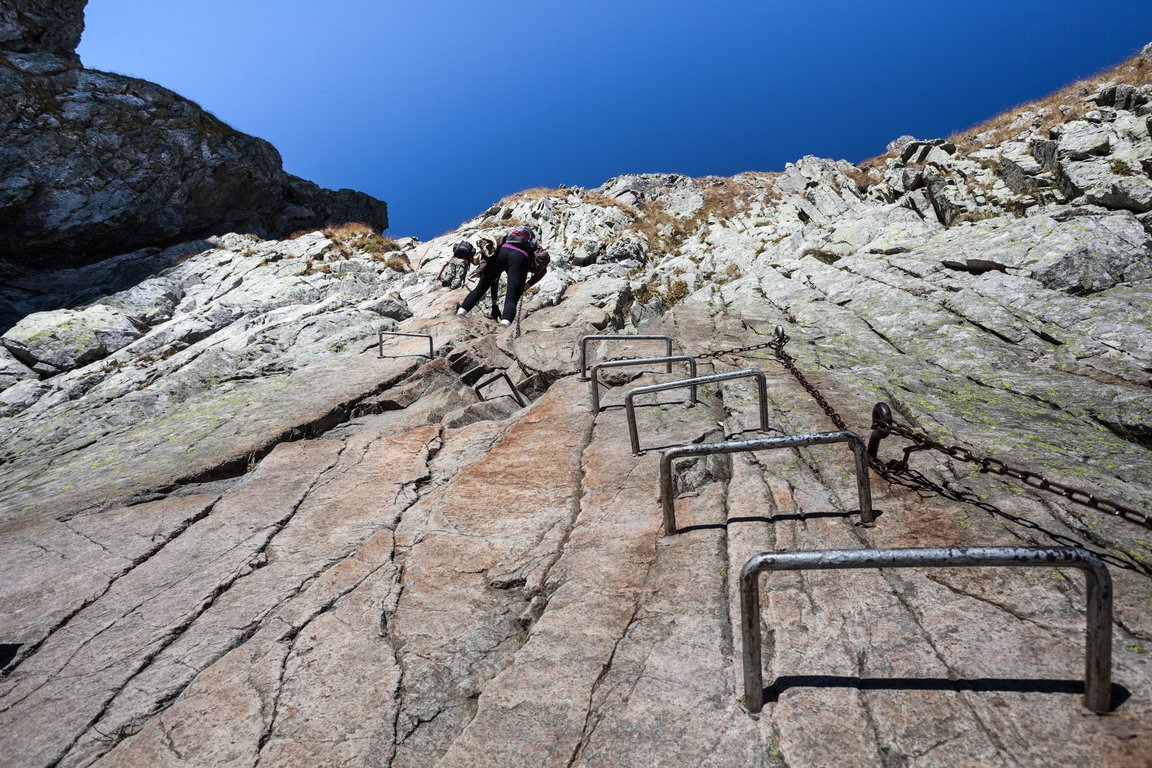
The metal stair on Priečne Sedlo pass © burasek79 / Adobe Stock
It is not suitable for hikers with a fear of heights (exposure!). Also, previous experience in high mountains will be useful here.
There are chains and metal stairs - this part resembles alpine via ferrata trails.
The majority of hikers climb it without any specific equipment but it is recommended to have a helmet and gloves.
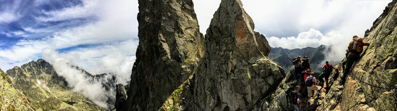
The trail is two-way but we need to remember to climb it on the right-hand side. This will prevent the path from getting jammed.
Also, there is not much space for the rest, so we need to climb this fragment quite fast.
After we climb Priečne Sedlo Pass, the trail becomes much easier to hike, a traditional stony pavement.
Getting to Zbojnícka Chata mountain shelter takes about 3 hours.
This mountain hut is located in Veľká Studená Dolina (Great Cold Valley) and is open all year round. There are 16 beds. Toilets are only outdoors. Hikers can use the shelter's kitchen to prepare their food or buy meals at the restaurant.
Contact details for Zbojnícka chata cottage:
Mobile number: +421 903 638 000
E-mail: [email protected]
Day 2 - Going to Horský Hotel Sliezsky Dom
This section describes the route from Zbojnicka chata to Horsky Hotel Sliezsky Dom. It is the second day out of a 3-day hike.
One thing about multiday hikes is that we can wake up early and we are already in the heart of the mountains and early mornings are the most spectacular times. In the mornings the air is clear the clouds are low it is the best time for admirers.
|
|
Length: (only one-way) | 4.35mi (7km) |
|
|
Elevation: (only one-way) | 2297ft (700m) |
|
|
Time: (only one-way) | 5:30 |
|
|
Beauty:
|
3 / 10 |
|
|
Difficulty:
|
7 / 10 |
Get a paper hiking map of Poland & Slovak Tatra.
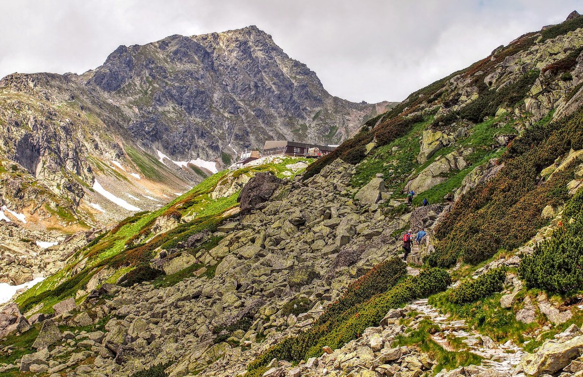
We set off from Zbojnícka Chata mountain hut on the blue path towards trail fork Prielom Rohatka (2290m). The first hour of our hike leads through a valley, the trail is scenic and not demanding.
Then we get to a steep rocky trail where we have some chains to facilitate the climb. This is an exciting part and some previous experience in high mountains comes in handy.
Soon after our demanding climb, we start hiking down to another trail fork - Pod Poľským hrebeňom (2110 m). When we get there we choose the green trail and start climbing up.
After 15 minutes we arrive at the next trail fork - Poľský hrebeň (2200 m) where we start our ascent on the yellow trail to Východná Vysoká mountain (2429m).
The trail is steep but no climbing is required.
In about 50 minutes our effort is rewarded with a fantastic panorama of High Tatras with its solemn peaks and beautiful postglacial lakes.
Climbing down to Poľský hrebeň trail fork takes about half an hour.
We start hiking down the blue trail which leads towards Sliezsky Dom mountain hut (1665 m). Getting to the shelter takes about two hours.
On our way, we pass two lakes - Dlhé Pleso and Velické Pleso.
The trail leads among High Tatra peaks. This part is easy - it is a comfortable Tatra stony pavement. There is one steep descent close to the mountain hut but it is technically easy to hike.
Horský Hotel Sliezsky Dom is a mountain hotel. The rooms are nice and comfortable, with TV and free Wi-Fi. There is a hotel restaurant and a lobby bar. The hotel even offers a wellness zone with a jacuzzi pool, saunas and massages.
Since it is possible to get to this hotel by car, it tends to be quite popular among tourists. Booking a room in advance is necessary.
You can check this mountain hotel here:
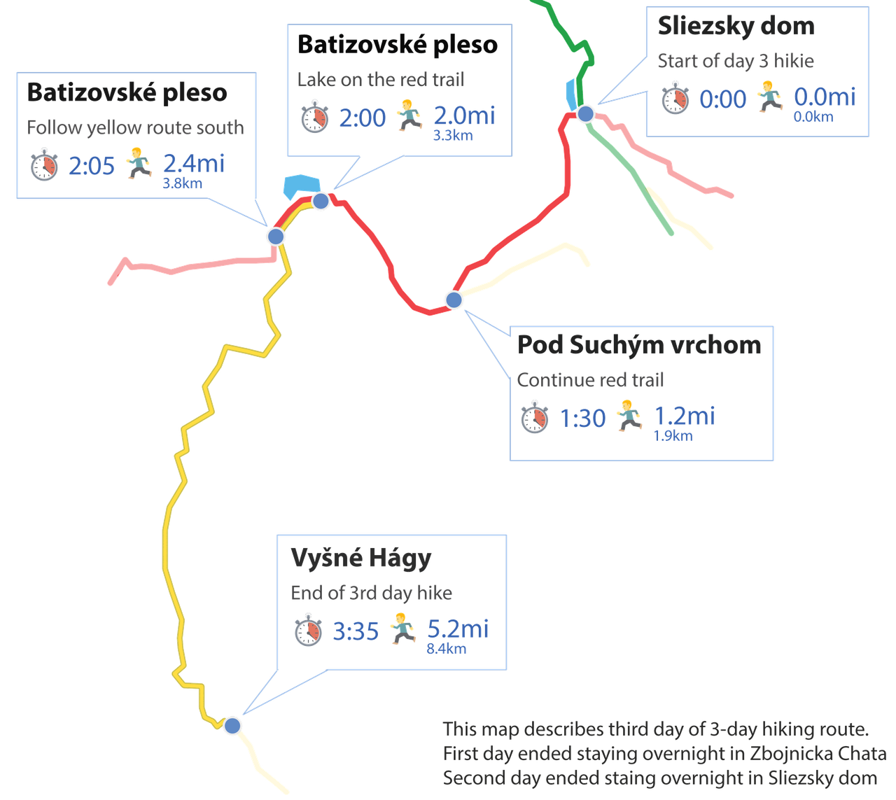
Day 3 - Going to Vyšné Hágy
This section describes the route from Horsky Hotel Sliezsky Dom to Vysne Hagy town under the mountains. It is the third and last day out of a 3-day hike. Today we will be saying goodbye to our mountains and hopefully, "see you soon" 😉
|
|
Length: (only one-way) | 5.28mi (8.5km) |
|
|
Elevation: (only one-way) | 951ft (290m) |
|
|
Time: (only one-way) | 4:30 |
|
|
Beauty:
|
5 / 10 |
|
|
Difficulty:
|
3 / 10 |
Last day of our hike. Not very challenging and technically easy to hike but very beautiful nonetheless.
We set off from Horský Hotel Sliezsky Dom on the yellow trail towards Pod Suchým Vrchom trail fork (1710 m). Getting there takes about 1.5 hours.
On our right side, we admire a beautiful mountain landscape.
When we get to the trail fork, we continue hiking the red trail. In half an hour we arrive at Batizovské Pleso Lake (1884m). It is a perfect place to have some rest and take photos.

After we pass the lake we soon arrive at a trail fork where we start climbing down the yellow trail towards Vyšné Hágy (1100m).
Getting to the village takes about 1.5 hours.
Vyšné Hágy is one of those small villages in Slovakia where you can get away from your everyday problems and enjoy amazing views of the Tatra mountains.
There are no tourist attractions, no crowds, only peace and quiet.
If you would like to stay in Vyšné Hágy, choose an apartment in Vila Horec. It's located next to the Tatranská elektrická tram station and grocery store.
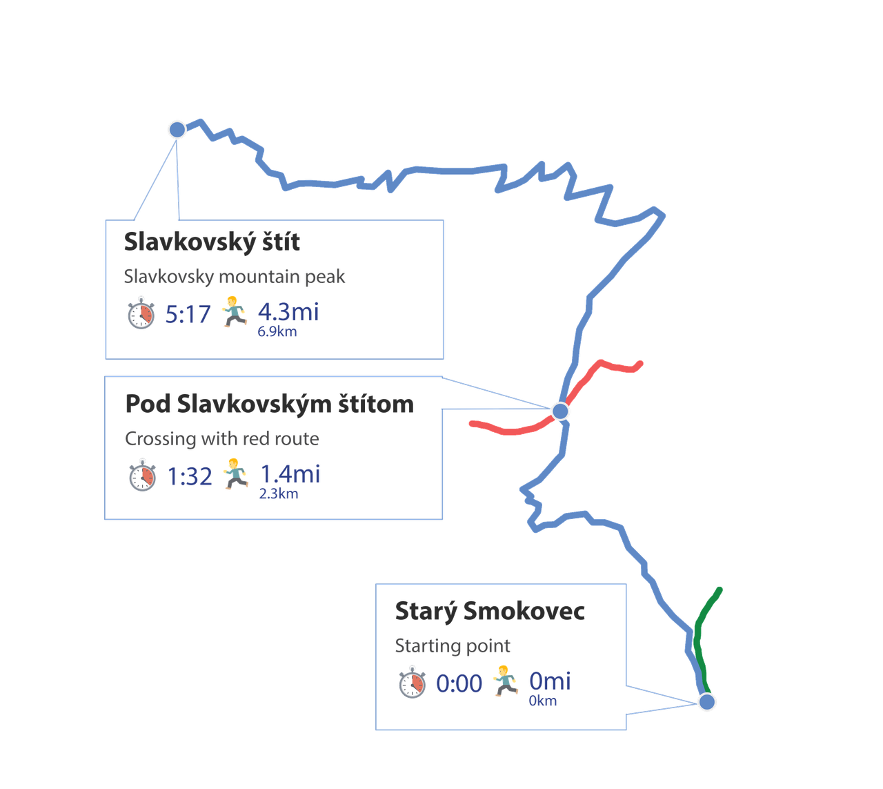
3. Slavkovský štít
This is the only High Tatra peak in Slovakia available for hikers in wintertime.
Slavkovský štít reaches 2452m. Many tourists consider it one of the best hikes in Slovakia. Reasons:
- it is one of the most easily accessible High Tatras hiking routes
- there is just one trail which starts in Starý Smokovec (Vysoké Tatry village)
- hikers do not need to walk long valleys to climb this mountain
- no chains or other technically difficult parts
However, we need to remember that the route is long and tiring - we need to hike 1450m of height difference.
|
|
Length: (Both ways) | 8.7mi (14km) |
|
|
Elevation: (Both ways) | 4757ft (1450m) |
|
|
Time: (Both ways) | 10:0 |
|
|
Beauty:
|
8 / 10 |
|
|
Difficulty:
|
5 / 10 |
Even though there is an overview map we always recommend getting a paper hiking map of Poland & Slovak Tatra.
We start our hike on the blue trail which starts in Starý Smokovec center. Soon the path enters a forest.
In about 1.5 hours we get to Pod Slavkovským štítom trail fork (1356m).
We continue hiking the blue trail and in about half an hour the beautiful view starts to emerge - with every step we see the amazing panorama of the south. Soon we will also get to admire High Tatras.
The blue trail gets steep at some points but is technically easy to hike. There are a few spots where the stony path can be a bit difficult to climb on a rainy day but this rule applies to all Tatra National Park trails.
If it is raining or snowing, it is better to think twice before going into the high mountains.
If the weather is favorable our effort is rewarded with a fantastic panorama of High Tatras.
The last part of the trail zigzags on a steep slope and is full of rock rubble. It is easy to slip down with colluvium, so it is good to have trekking poles (so useful, especially when climbing down).
If we lose the blue mark from sight we do not need to worry much - there are a few paths which connect near the mountaintop.
Slavkovský štít is situated front-end to High Tatra peaks which makes it a very picturesque mountain. It is not a fast and easy hike but definitely worth the effort.
There is no mountain hut on the way, so it is necessary to take plenty of water and snacks.
To summarize we put this trail overview on the timeline for you:
Starý Smokovec (Vysoké Tatry)
Distance: 0
Time: 0.00
Altitude: 3356ft (1023m)
Coordinates: 49.140928, 20.220109
Pod Slavkovským štítom
Distance: 1.4mi (2.3km)
Time: 1:32
Altitude: 4448ft (1356m)
Coordinates: 49.153580, 20.210362
Slavkovský štít
Distance: 4.7mi (6.9km)
Time: 5:17
Altitude: 8044ft (2452m)
Coordinates: 49.166048, 20.184803
Pod Slavkovským štítom
Distance: 7.2mi (11.6km)
Time: 8:02
Altitude: 4448ft (1356m)
Coordinates: 49.153580, 20.210362
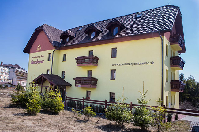
Stay in Horny Smokovec & Starý Smokovec
Stay here to be right in the starting point for routes:
Horný Smokovec and Starý Smokovec are both great starting points of many hiking trails. Quiet, nice villages with an added bonus - beautiful scenery. They are just less than a mile apart from each other.
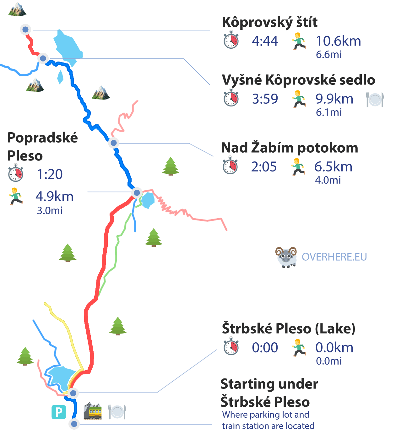
4. Kôprovský štít
This hike is technically easy, with no chains or exposure points on the way. However, like the majority of Slovak Tatra trails, it is quite long and requires a certain level of fitness and stamina. But still, it is one of the easiest peak hikes in High Tatras.
|
|
Length: (Both ways) | 13.05mi (21km) |
|
|
Elevation: (Both ways) | 4856ft (1480m) |
|
|
Time: (Both ways) | 10:0 |
|
|
Beauty:
|
8 / 10 |
|
|
Difficulty:
|
5 / 10 |
It's always a good idea to have with you on a trip a paper Tatra Mountains map.
It is not a circular trail and we need to climb down the same way but the hike is so beautiful that we will not get bored on our way down.
We start our trip in Štrbské Pleso mountain resort. Let's not get discouraged by crowds there - the majority of hikers would probably walk to Rysy Peak 😉
The red trail leading to Popradské Pleso Lake is nice, easy and picturesque. Getting to the lake takes about 1 hour. There is also a mountain hotel with a restaurant.
If we have a lot of time and energy, we can check the symbolic cemetery near Popradské Pleso. It commemorates all the mountain guides and rescuers who lost their lives in Tatras.
In Popradské Pleso we take on the blue trail leading towards Nad Žabím Potokom (1620m). In the beginning, we hike in the forest, but soon we get to the clearing and start admiring the emerging High Tatras peaks.
When we arrive at Nad Žabím Potokom trail fork, we continue hiking the blue trail. It is not demanding, and the trail ascends mildly.
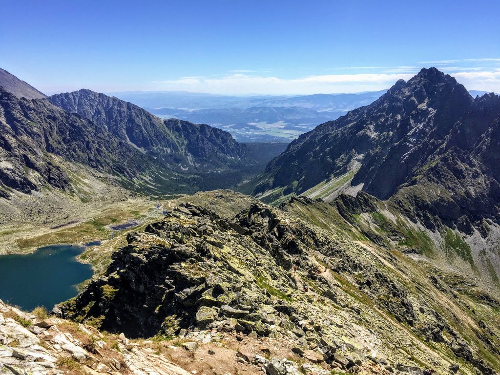
Now we hike towards Vyšné Kôprovské Sedlo Pass (2180m). This part takes about 2 hours.
After a while, the trail gets steeper, but it is still technically easy to hike. Anyway, when we get o the valley near Veľké Hincovo Pleso Lake, the trail gets almost flat.
This place is perfect for a break.
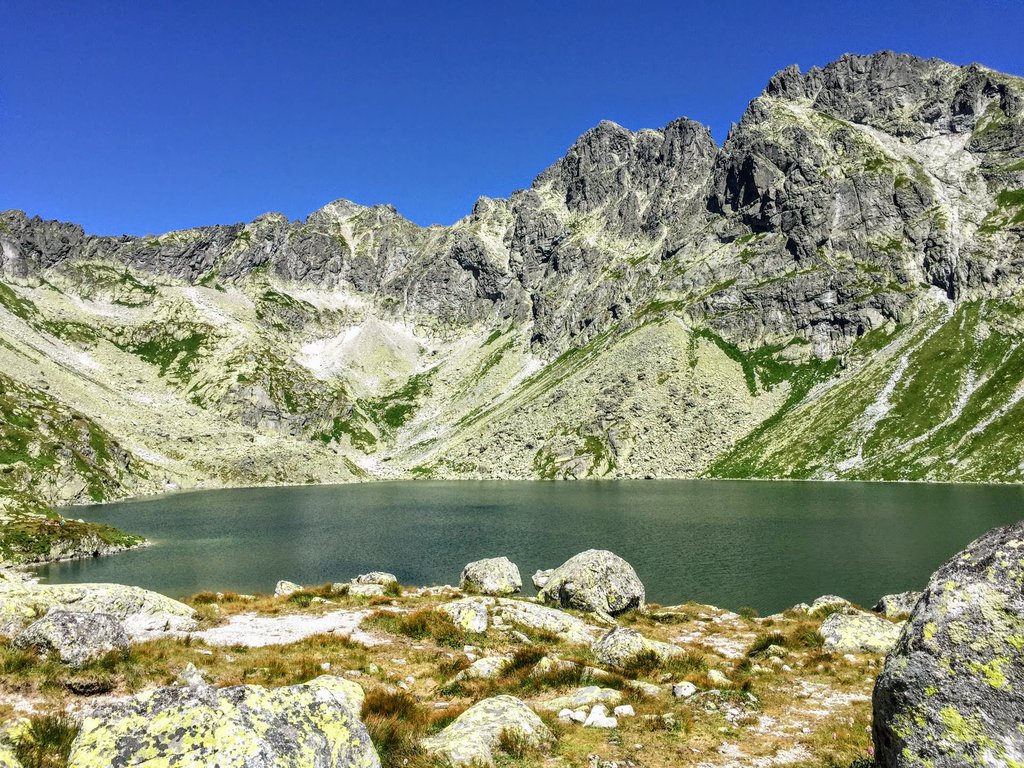
After we absorb the immense beauty of High Tatras we continue hiking the blue trail. After a while, the trail gets steeper but the path zigzags on the slope - we climb to Vyšné Kôprovské Sedlo Pass.
When we arrive at the trail fork we have only one option to choose - the red trail leading towards the mountain top. This will take us about 1 hour.
At first, the path leads us on a rocky slope. Then it changes into rubble. This is the most exciting part of the hike, but we also need to be cautious. At some points, we may use our hands to climb big rocks but it is technically easy and no climbing skills are necessary.
Kôprovský štít mountain top (2363m) is rather narrow and there is not a lot of space. A dozen hikers on the top make it crowded. Kôprovský štít looks innocent from the trail, but it descends really steep from other directions.
Fortunately, this mountain is not as famous as Rysy or Kriváň, so if we start our hike early in the morning, we will be able to enjoy the breathtaking panorama in peace. During sunny weather, the 360° view is unforgettable and we will get a chance to take fantastic photos! 💚
Stay in Štrbske Pleso
The closest settlement to the mountains, modern, with high standard and beautiful
The best location for hikers! To begin our hikes all we need is to walk out of our hotel building. We can walk to Rysy, Krivan and many the most famous locations right from here. It is the most convenient way if our main priority is time.
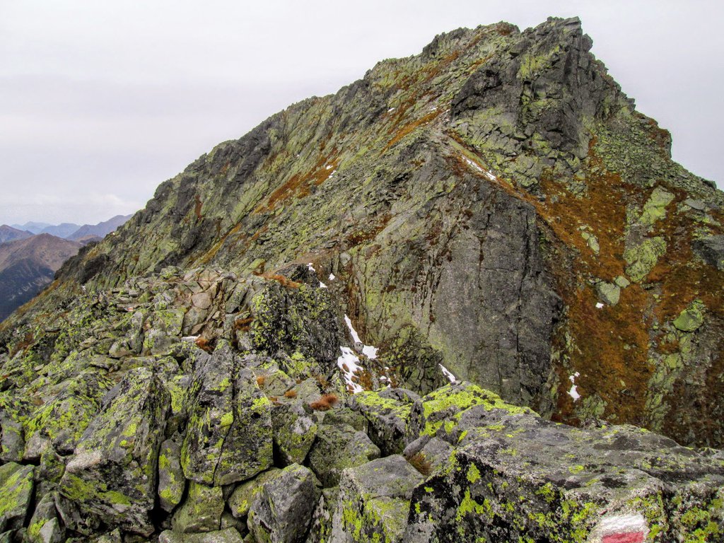
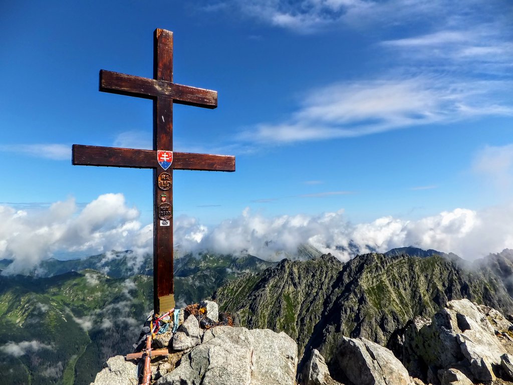
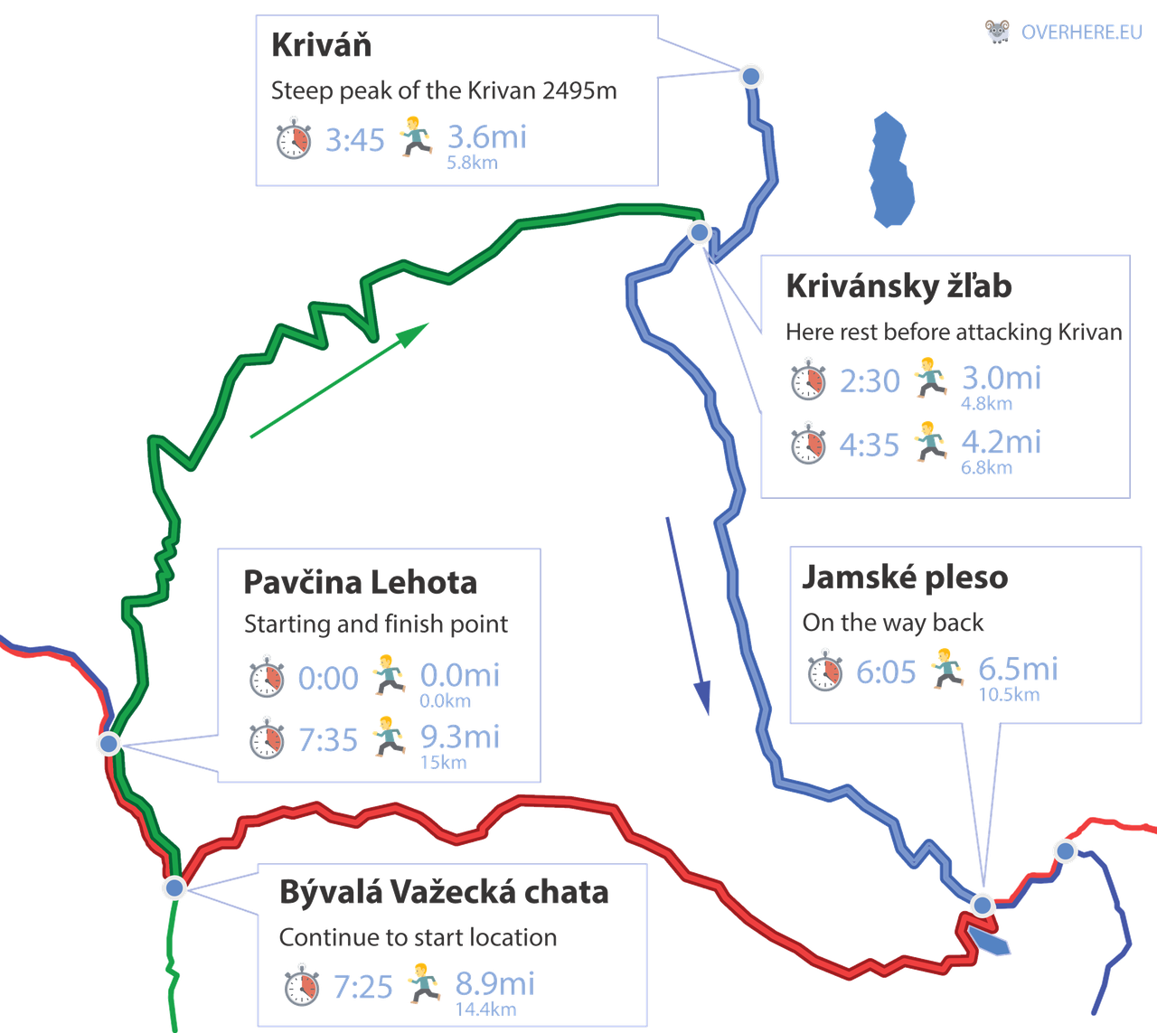
5. Kriváň
|
|
Length: (only one-way) | 9.32mi (15km) |
|
|
Elevation: (only one-way) | 4659ft (1420m) |
|
|
Time: (only one-way) | 8:30 |
|
|
Beauty:
|
9 / 10 |
|
|
Difficulty:
|
7 / 10 |
Get a paper hiking map of Poland & Slovak Tatra.
Kriváň reaches 2495m and is a national Slovak mountain. It symbolizes Slovakia's revival, is mentioned in the national anthem and is even imprinted on Slovak coins.
Many hikers consider Kriváň one of the best High Tatras hiking routes - panorama from the mountain top takes the breath away. Also, there are many picturesque places on the way to Kriváň Peak. It is a true paradise for mountain lovers and photographers.
There are three trailheads from which we can climb Kriváň:
- the green trail from Tri studničky
- the red trail from Štrbské pleso
- the blue trail from Podbanské Biely Váh
In my opinion, the first option is best. It is not easy, there is a lot of height difference to hike and the ascent is long and tiring. Also, there is no mountain hut on the way. But the effort is well rewarded with beautiful views.
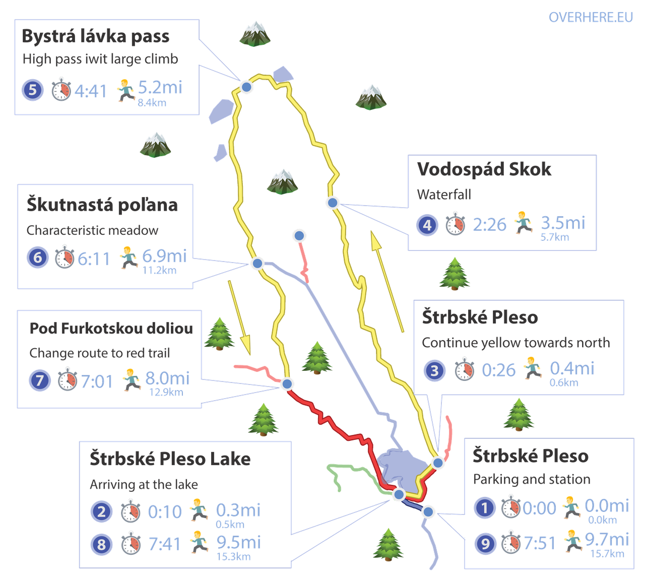
6. Bystrá lávka
|
|
Length: (only one-way) | 9.94mi (16km) |
|
|
Elevation: (only one-way) | 3510ft (1070m) |
|
|
Time: (only one-way) | 8:30 |
|
|
Beauty:
|
8 / 10 |
|
|
Difficulty:
|
5 / 10 |
For me, this is one of the best hikes in Tatras (and also one of the best mountain hikes in Europe).
Here is why:
- not so much height difference to hike as in other High Tatra trails
- the views are amazing
- a waterfall on the way
- several scenic postglacial lakes
- chains which make this hike even more exciting
- the pass is located between two amazingly beautiful valleys - Mlynická Valley and Furkotska Valley
- the trail is not as popular as Rysy or Kriváň, so there are no traffic jams and crowds on the way
Important info: the trail up to the Vodospád Skok waterfall is available for hikers all year.
Check here for a detailed description of this route.
Stay in Štrbske Pleso
The closest settlement to the mountains, modern, with high standard and beautiful
The best location for hikers! To begin our hikes all we need is to walk out of our hotel building. We can walk to Rysy, Krivan and many the most famous locations right from here. It is the most convenient way if our main priority is time.
7. Kościelec (Polish Tatra)
Now let's have a look at Polish Tatra National Park hiking trails. In High Tatras Poland there are some of the best places to hike in Europe! 💙
|
|
Length: (Both ways) | 9.94mi (16km) |
|
|
Elevation: (Both ways) | 4593ft (1400m) |
|
|
Time: (Both ways) | 8:30 |
|
|
Beauty:
|
10 / 10 |
|
|
Difficulty:
|
8 / 10 |
Kościelec reaches 2155m. It is also called Polish Matterhorn - it is very similar to the famous Swiss pointed mountain.
Hikers can admire its full characteristic shape from Gąsienicowa Valley - scenic High Tatra Valley.
Kościelec looks hostile and almost impossible to climb but in fact, the path leading to the mountain top is not that difficult (provided it's not rainy).
Keep in mind that the final part of the trail requires a bit of using your hands. It's not suitable for hiking beginners and people with a fear of heights.
The majority of difficulties on this trail are caused by the lack of artificial facilitations - we are on our own, with no chains, no iron steps.
Up until Karb Pass (1853m), the trail is nice and easy and suitable even for beginners. Closer to the mountain top there are three problematic spots which sometimes create traffic jams on the path (especially on a rainy day).
All in all, the Kościelec trail is exciting and, like other High Tatra mountains, it rewards well the climbing effort. Additional bonuses on the way are Murowaniec mountain hut (great food!) and Czarny Staw Gąsienicowy Lake (1628m) - one of the best places to visit in Tatra mountains in Poland.
Places to stay in Zakopane
Stay here to be near ~3mi(Kuźnice) or ~10mi(Palenica Białczańska) at starting location for routes:
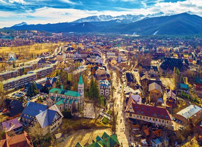
Zakopane city is one of the most popular touristic destinations in Poland. Mainly because of nearby marvel High Tatra Mountains. Tatras are the most breathtaking mountains in this part of the continent. But Zakopane also has a couple of own attractions that we shouldn't miss. It's a good place for people that want to stay close to shopping streets, restaurants and museums.
8. Szpiglasowy Wierch (Polish Tatra)

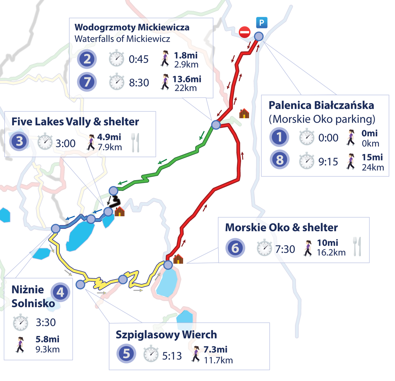
|
|
Length: (Both ways) | 14.91mi (24km) |
|
|
Elevation: (Both ways) | 4790ft (1460m) |
|
|
Time: (Both ways) | 10:0 |
|
|
Beauty:
|
9 / 10 |
|
|
Difficulty:
|
9 / 10 |
Szpiglasowy Wierch peak reaches 2172m. For me, it is one of the most beautiful hiking trails in High Tatras in Poland.
Did you know that the Tatra Mountains are also called the "Polish Alps"? Szpiglasowy Wierch is an excellent example of an alpine-like mountain.
Many mountain lovers consider Szpiglasowy Wierch as one of the best hikes in Poland.
This route includes Valley of the Five Lakes (1672m) and Morskie Oko Lake (1406m). Both are thought to be the most beautiful places to visit in Poland.
There are two mountain huts on the way so it is not necessary to carry too much food. It is worth remembering that those shelters are open all year round but are highly popular among tourists as both are easily accessible.
The fantastic panorama of High Tatra accompanies us almost during the whole hike (if the weather is favourable).
There are chains in one point but this part is not technically difficult and every mountain hiker should be able to pass it without any issues. Generally, this trail is the best example of easy hikes in High Tatras.
However, the route is long. A 24-kilometre-long hike in the mountains is appropriate for fit hikers.
I recommend hiking it in the direction given here. The more difficult part is on the yellow trail leading from Valley of the Five Lakes and it is always better to climb up the harder part and walk down on the easy path.
Places to stay in Zakopane
Stay here to be near ~3mi(Kuźnice) or ~10mi(Palenica Białczańska) at starting location for routes:
Zakopane city is one of the most popular touristic destinations in Poland. Mainly because of nearby marvel High Tatra Mountains. Tatras are the most breathtaking mountains in this part of the continent. But Zakopane also has a couple of own attractions that we shouldn't miss. It's a good place for people that want to stay close to shopping streets, restaurants and museums.
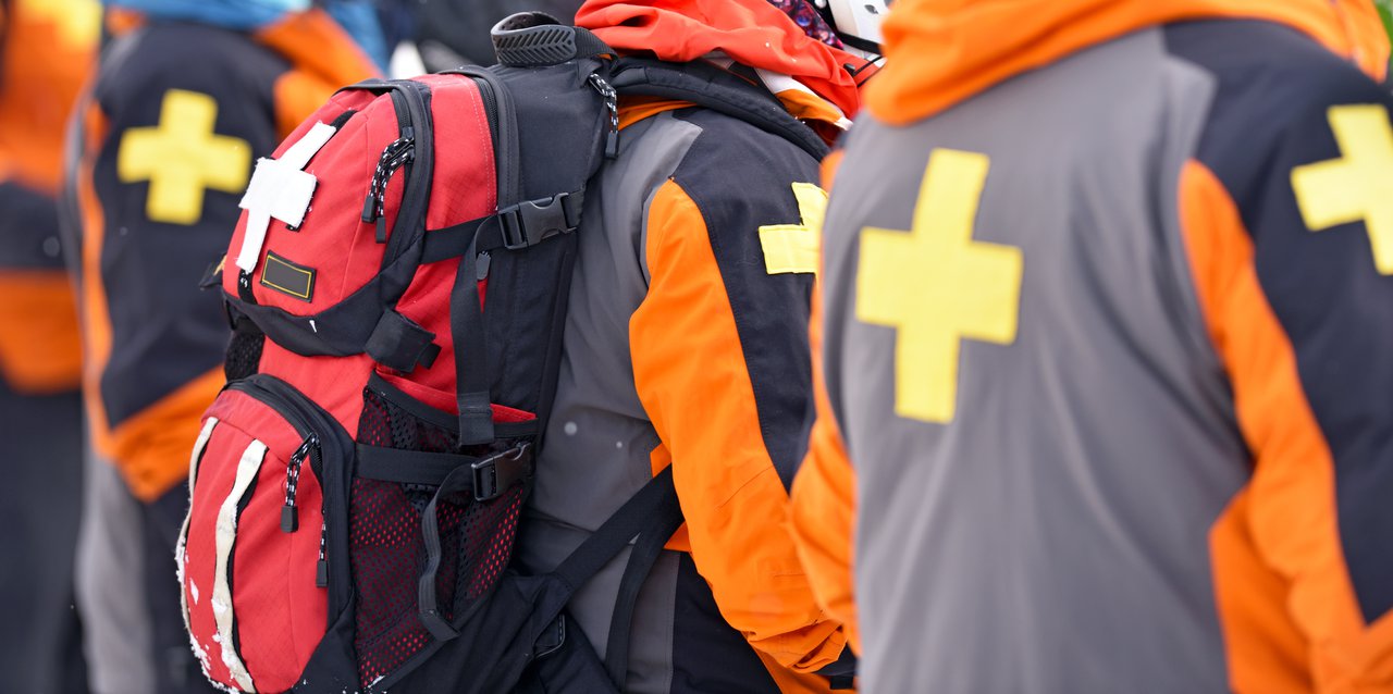
Tatra Mountains - safety information
© Brett / Adobe Stock
- Plan well your mountain hike. Check the time of a hike, difficulties, trail description, etc.
- Take a Tatra Mountains map with you. Phones and tablets are not reliable in the high mountains.
- Trails in Slovak Tatras above mountain huts are closed from November 1st until June 15th.
- Emergency numbers in Tatra mountains:
Poland: 985 or 601 100 300
Slovakia:18 300 - Have an ICE card (In Case of an Emergency card). It is a small card with contact details to a person who should be informed if an accident happens. They should also be able to provide health information about you - medicines, blood type, etc.
- Inform about your trip your family and/or friends. Tell them exactly where you are planning to hike.
- Get yourself a comfortable backpack.
- Take plenty of water and warm tea. Dehydration leads to weakness.
- Remember about nutritious food.
- Check here what to take for a mountain hike.
- Check the weather forecast. Weather in Tatra mountains tends to be unpredictable and changes quickly. If there is a thunderstorm predicted for the afternoon, it is best to resign from the trip.
- Start your hike as early in the morning as possible. It is better to have a lot of time for climbing down. Also, thunderstorms are more frequent in the afternoons.
- Winter hiking is more difficult and dangerous than a summer trip. Prepare well.
- Remember about sports insurance. Rescue missions in the mountains are very costly.
- Avoid these common mistakes made by mountain hikers.
- The majority of hiking trails in High Tatras are demanding and require good physical condition. It is always good to work out at least several weeks before your mountain trip.
Weather in High Tatras
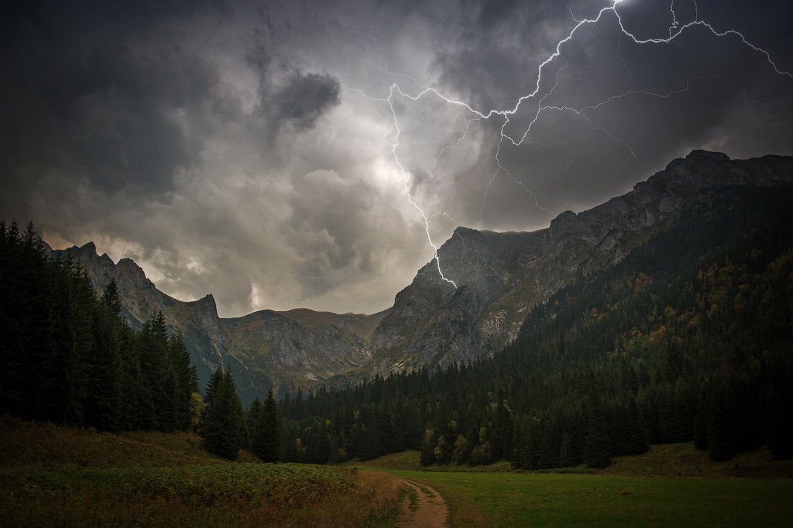
The Tatra Mountains, also known as the "Polish Alps" (I like to repeat that 😉) are the only mountains in this part of Europe with an alpine climate.
As you go up, you see different plants and deal with different weather. You could be enjoying a warm day down in the valley, but up top, it's a whole different story - snow-covered peaks and a freezing breeze.
And let me tell you, the weather up in the High Tatras is wild! It can change in the blink of an eye, keeping you on your toes.
Take a look at this informative guide about the weather in Tatra Mountains. I hope it will help you enjoy a safe trip.
How to get about there?
The most efficient and comfortable way to travel between Tatras' towns and villages is to drive a car. You can check deals on car rentals here:
Alternatively, you may travel by Get Your Guide transfer from Kraków Airport to Zakopane, and then use buses to get about.
If you prefer to travel by tram and bus you have the below options:
Poland
To get to the trailheads it's best to travel by private buses which shuttle from the central station in Zakopane center on Kościuszki 23 Street (Google Maps link).
To find a bus which will take you to your preferred trailhead simply look at the tables at the front window.
In the summer, buses start to shuttle at 6 AM and are very frequent. It's worth mentioning that drivers usually don't depart strictly according to the timetable - they wait until the bus is full and then depart (buses fill up very quickly).
There are lots of shuttles to the trailheads so you just come to the bus station, choose the right bus and shortly you'll be on your way.
You may buy the ticket at the bus driver's - cash only.
Slovakia
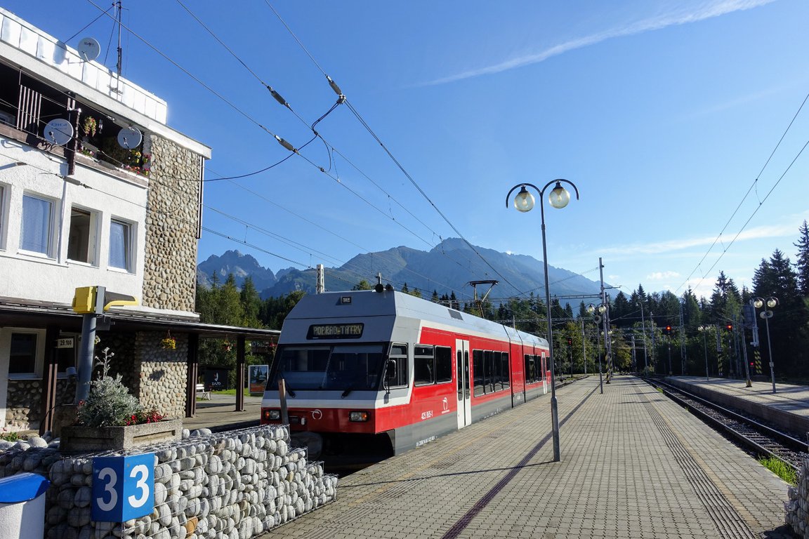
If you prefer public transportation, the best option is the Tatra Electric Railway (Tatranská elektrická železnica). It is a narrow-gauge electric railway located in the High Tatras, Slovakia.
It connects all the most important towns and villages at the foot of High Tatras - from Tatranská Lomnica to Štrbské Pleso.
We have used it several times and it was fun. What I like the most about the Tatra Electric Railway are the scenic views on the way. Ride on this narrow-gauge electric railway is an interesting attraction in itself.
You may buy the tickets at some of the stations (e.x. Tatranská Lomnica and Štrbské Pleso) or online here.
The ticket has to be stamped in the stamping machine immediately after boarding the train.
Other beautiful hikes in Tatra Mountains
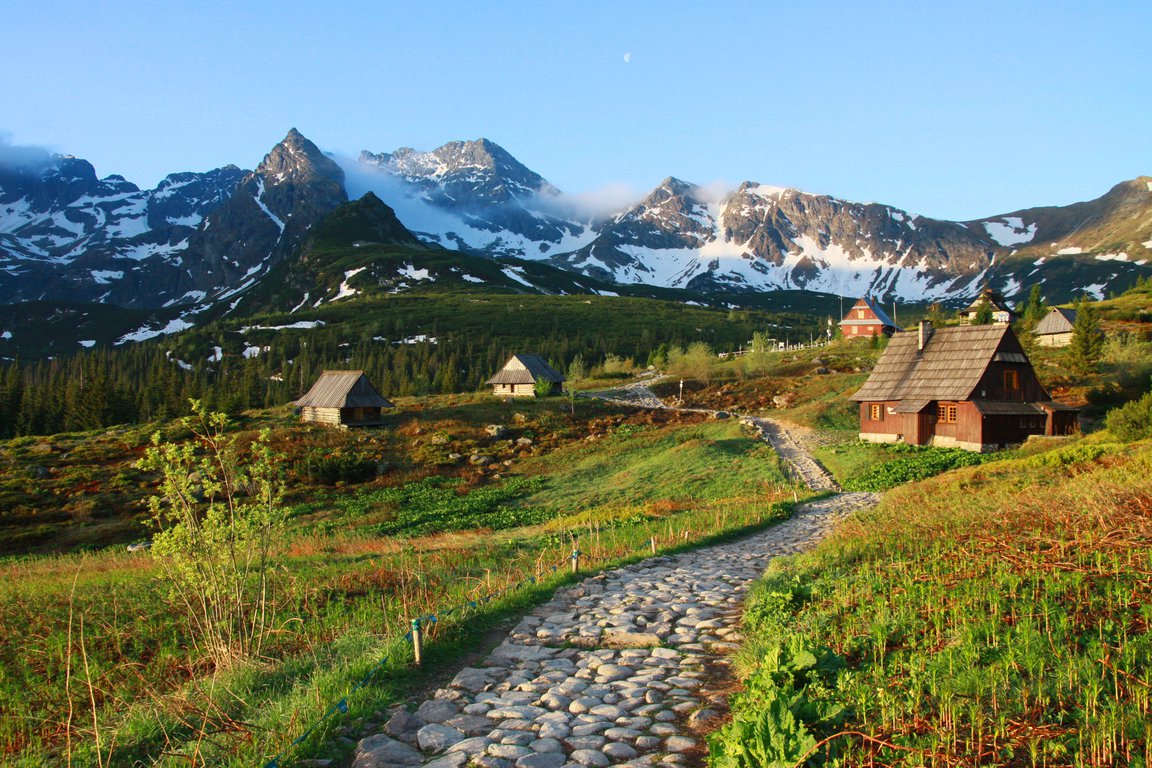
Popradské Pleso after the sunrise
If you'd like to explore other hiking trails in Tatra Mountains, check out the below posts:
⛰️ Easy hikes in High Tatras - suitable for beginners and families with kids
⛰️ The most beautiful hikes from Zakopane
⛰️ Interesting day hikes in Tatra Mountains Poland
⛰️ Hiking in Western Tatras in Slovakia
⛰️ Štrbské Pleso Lake & Popradské Pleso Lake - High Tatras Slovakia
I wish you many happy hikes in Tatra Mountains!
Stay in Štrbske Pleso
Stay here to be right in the starting point for routes:
The best location for hikers! To begin our hikes all we need is to walk out of our hotel building. We can walk to Rysy, Krivan and many the most famous locations right from here. It is the most convenient way if our main priority is time.

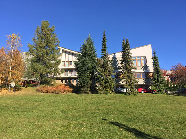
Stay in Horny Smokovec & Starý Smokovec
Stay here to be right in the starting point for routes:
Horný Smokovec and Starý Smokovec are both great starting points of many hiking trails. Quiet, nice villages with an added bonus - beautiful scenery. They are just less than a mile apart from each other.
Stay in Zakopane
Stay here to be near (~3.5mi or ~5km) in the starting point for routes:
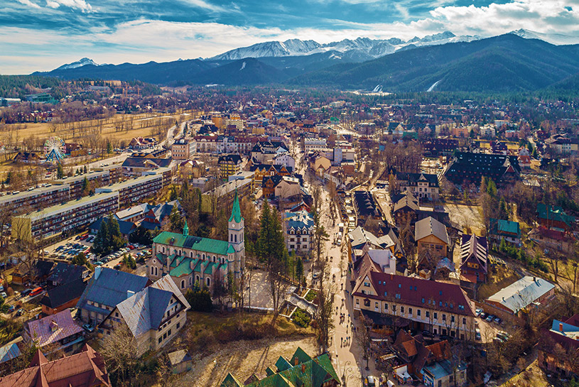
Zakopane city is one of the most popular touristic destinations in Poland. Mainly because of nearby marvel High Tatra Mountains. Tatras are the most breathtaking mountains in this part of the continent. But Zakopane also has a couple of own attractions that we shouldn't miss. It's a good place for people that want to stay close to shopping streets, restaurants and museums.


