Hiking in Gran Canaria is one of the best things you can do on this beautiful Spanish Island.
It's definitely not easy to spend all the vacations on the beach! The island offers a variety of hikes to suit all fitness levels, from gentle coastal strolls to challenging climbs up volcanic peaks.
Over 2000 kilometres of roads and trails lead through mountains, picturesque towns and villages, pine forests and coastline.
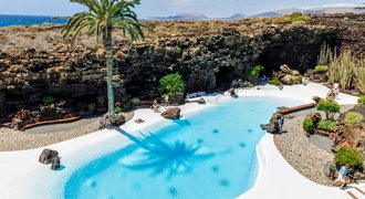
In Gran Canaria, you will find charming old towns, sandy beaches and dunes, captivating botanical gardens (the most popular one is in Las Palmas), volcanic craters, plantations of exotic fruits and coffee. It's also the only Canary Island in which caves there still live native aborigines.
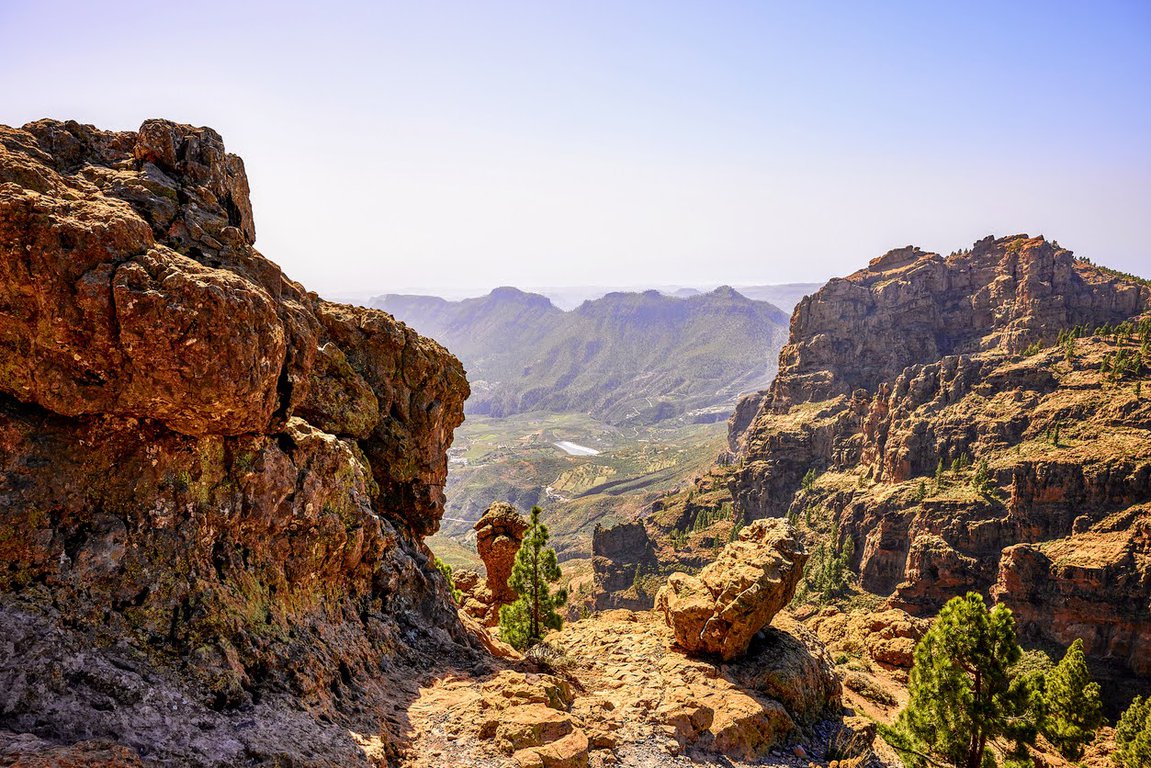
But it's the mountains which are the biggest magnet for me, the raw volcanic mountains which are so different than our continental peaks.
So, let's have a look at my subjective list of hikes in Gran Canaria which will leave you in awe.
Hiking in Gran Canaria
Before you read about Gran Canaria, check also the below Canary Islands' guides:
🌴 Driving in Gran Canaria - what to know before you go
🌴 10 things to do in Gran Canaria for amazing vacations
🌴 8 things to do in Tenerife for adventure seekers
Hiking in Gran Canaria - good to know

Exploring Gran Canaria's hiking trails is the best way to experience the island's rich natural beauty and varied landscapes. When selecting trails, I prioritized length, elevation gain, and scenic appeal, aiming for enjoyable walks rather than strenuous mountain climbs.
Be aware of the following before you hit the trail:
Trail marking
Unlike Poland's well-marked trails, Gran Canaria's routes tend to have minimal signage. There are mostly signs at the start and end points. This can make it easy to stray from the intended path, as I've personally experienced. Therefore, having an offline tourist map readily available is crucial for your hiking adventures.
Additionally, hiking boots are essential to protect your feet from the rugged terrain. Opting for sandals or similar footwear is a recipe for an orthopedic surgeon's visit.
Weather

Photo taken around 9 AM

4 PM the same day
Gran Canaria's weather is notoriously unpredictable, especially in the mountainous regions. During our week-long stay in February, the island threw everything at us, from balmy 6°C mornings to scorching 28°C afternoons, blazing sunshine to icy downpours, and even misty fog! A mere 15-kilometer drive could often plunge us into an entirely different weather system.
We quickly learned to pack for all eventualities, including long pants and even winter jackets. We laso remembered to carry ample water and sunscreen, especially during sunny weather hikes.
While Gran Canaria's unpredictable weather may require some flexibility in your plans, it also adds an element of excitement and adventure to your trip. Embrace the island's diverse climate and enjoy the unique experiences it offers.
1. Roque Nublo

Length: 3 km in total
Level of difficulty: low to medium
Type: out and back
It's one of the most popular hikes in Gran Canaria. It's as important for Canariones as Teide volcano in Tenerife.
It used to be a cult place for the aboriginal inhabitants. Nowadays, the island's anthem starts with mentioning Roque Nublo, writers create poems about it, it's a popular element in patriotic songs and lovers come there to spend their dates. When in 2010 island's government proposed to build a chairlift from nearby village to the rock, Roque Nublo enthusiasts started to vigorously protest.
Fortunately, there's no lift whatsoever.
This 80-metre high basalt rock is located on 1813 metres. It's considered the most impressive natural monument in Parque Rural del Nublo. It's also the highest volcanic rock in the world, and a great example of the fact that volcanic eruptions wreak havoc, but can also create natural wonders.
The easiest way to get to Roque Nublo is by car, travelling on road GC-60 which leads to Ayacata village, where we turn to road GC-600. After 3 kilometres there's parking space signed "Roque Nublo". To be sure there's space available it's best to arrive early in the morning. You may grab a snack or drink from the food truck before you set off.
There's nice and easy hiking trail leading to the monolith. It's 1.5 kilometres long, and getting to the monument takes about 30 minutes of relaxed walking.
I loved the amazing views! This trail is well-marked and easy to navigate, although there are sections with a steep climb. Sturdy shoes are a must. The weather can change quickly near Roque Nublo – expect clouds and wind, but that just adds to the adventure. Most of the trail offers nice shade from the trees.
When you get to the rock, it's worth to remember to kiss Roque Nublo - Canariones believe it brings good luck. 😉
If this short walk isn't enough for you, you can continue hiking to Barranco de Tejeda gorge. Then, only 1 hour more and you're at Roque Bentayga - another breathtaking volcanic formation.
2. Caldera de Bandama

Length: 3.4 km in total
Level of difficulty: low
Type: loop
Breathtaking caldera located close to the island's capital Las Palmas de Gran Canaria (here is the location). It's nice and easy option both for experienced hikers, as well as families with children.
In fact, every nature aficionado will consider it one of the best hikes in Gran Canaria. Abundant greenery and interesting landforms create fascinating scenery!
This circular hike will take about two and a half hours and will provide you with the breathtaking landscape of 1000-metres wide volcanic hollow. It's a great option if you only have a couple of hours - this trail is only about 3 kilometres long.
The initial climb might test your legs, but the trail eases up as you descend. However, loose gravel covers much of the path, so watch your step on both the ascent and descent. The base of the caldera is a welcome respite, offering flat terrain and a couple of stone benches for a picnic break.
This route offers a double adventure: venturing through the valley followed by a loop around the rim.
Beyond the rim, an additional adventure awaits: venturing into the caldera itself. A short but steep descent leads to the caldera's floor, where you'll find a surprising oasis of lush vegetation. There's also La Casa de Agustin, an abandoned farmhouse that once served as home to the caldera's last resident, who passed away in 2020.
While generally manageable, some sections require extra effort, especially climbing out of the valley. To avoid the heat, start early and wear hiking shoes.
IMPORTANT: access to the path is restricted between 8 am and 5 pm.
The easiest way to get to Caldera de Bandama is to go on road GC-4, then in a village Monte Lentiscal turn to road GC-802. There's parking space in Bandama village, but it's not very big, so, as always, it's best to get there early in the morning to avoid crowds.
You can also reach the caldera by 311 bus line from Las Palmas or San Brigida. There is one bus every hour. You can plan your trip here.
3. San Bartolomé de Tirajana

Length: 13.5 km
Level of difficulty: medium
Type: loop
This trail kicks off in San Bartolomé de Tirajana and winds its way through several scenic points, including the Mirador Degollada de la Cruz Grande, Morro Guanil, Morro de las Vacas, Degollada de la Manzanilla, and sections of the S-60 and S-57 trails.
The beginning is a bit steep at some points but eases off considerably later, transforming into a pleasant stroll. I consider this hike an easy-to-follow route, but you'll need a decent level of fitness because of the length.
Be prepared for:
- Dusty terrain - roughly two-thirds of the path is unpaved, kicking up dust and glare.
- Limited shade - sun protection is essential due to minimal shade coverage.
- Lengthy stretches - the open path might feel a little monotonous despite the decent pace.
- Easy navigation - perfect for a group hike where conversation takes priority over route-finding.
This picturesque trail is moderately popular among tourists so the added bonus here is no crowds. It's partly located in the Pilancones Nature Park which, for me, is one of the most beautiful natural areas in Gran Canaria.
On your way you'll get to admire Morro de las Vaca, Morro Guanil and Morro de la Cruz Grande mountain peaks.
4. Barranco de los Cernícalos

Length: 7 km
Level of difficulty: low
Type: out & back
Gran Canaria's landscape is famous for its numerous ravines, known locally as "barrancos." Among these, Barranco de Los Cernícalos stands out as one of the most noteworthy.
Its year-round flowing stream, a rarity on the island, nourishes a vibrant array of vegetation, ranging from cacti to Canary willows. Actually, this unique ravine is famous for the largest concentration of plants in Gran Canaria. I felt there as I were hiking in an exotic faraway jungle!
Initially, the stream in the upper reaches of Barranco de Los Cernícalos is channeled into a watercourse similar to Madeira's levadas. However, as you hike deeper into the ravine, the surroundings transform into a wilder, lush paradise.

At times, the trail winds through a low, plant-arched tunnel, creating a unique experience. Towards the end of the ravine, a series of waterfalls cascade down. I love listening to waterfalls and I highly appreciated this soothing sound! To see all the waterfalls, take a slight detour to the right, uphill.
Keep in mind that there are very little trail markers - you need to have a map.
While Barranco de Los Cernícalos has a few slightly steep places, it's a technically easy trail. The round-trip hike measures approximately 7 kilometers, following the same path back. The great thing is that there are many shaded sections which makes it a great option for hiking in Gran Canaria on hot days.
Parking is available at one of the small car parks in Los Arenales marked as "Area Recreativa" on maps (location here).
5. Barranco del Álamo

Level of difficulty: low
Type: out & back / loop
This one is my favourite Gran Canaria hike! It's another short but stunning trail leading through lush greenery that would make a Central European in February dizzy. Nasturtiums, clover, cacti, and palm trees grow side by side - to name just the most eye-catching ones. Oh, and monstera plants with leaves as big as beach umbrellas.
However, the best attractions of the Barranco del Álamo trail are the ladder climbs - a fun twist to the hike along the ravine floor. The highest ladder is about four meters tall!
The trail starts in the village of Teror. You can start from several points in the village. We decided to start from a parking lot near the Fuente Agria, the Teror Water Factory. It's easy to park there and you are only a few hundred meters from the start of the route. You may also descend to the ravine from Calle Monteverde.
Luckily, the Barranco del Álamo trail is signposted - otherwise it would be impossible for us to find.
You can return the same way or take rural roads with minimal traffic. If you prefer to hike a loop, return to Teror via the Camino Real del Álamo (asphalt road) which shares the route with the S-15 (Teror- Cruz de Tejeda).
The whole trail is about 5 km long.
By the way, it's worth staying longer in Teror. It's a charming town famous for the cult of Our Lady of the Pine - the patron saint of Gran Canaria. Besides an interesting church and flocks of chickens roaming freely around the old town, it's worth paying attention to the carved wooden balconies - a characteristic element of Teror's architecture.
For coffee and a bite to eat, I recommend Bar Nuevo Iris on the square by the church, which serves sandwiches and tapas. Portions are fair and prices reasonable.
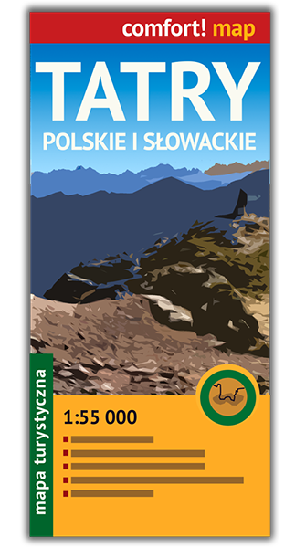
Hiking map of Gran Canaria
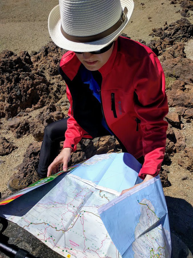
Having a paper map often comes in handy:
✅ Unlike digital maps that rely on the internet, a paper map is accessible at all times, regardless of location or network availability.
✅ Paper maps don't rely on batteries or electronic devices, making them dependable and immune to technical malfunctions or battery drain.
✅ Using a paper map eliminates the need for data usage, which can be costly or limited when traveling internationally. You can avoid roaming charges and data overages by relying on a paper map instead.
If you'd like to come prepared for all eventualities, check out this Gran Canaria hiking map. It's waterproof, durable and easy to unfold and refold. It has high ratings on Amazon.
Transportation

Buses
Gran Canaria has quite a well-developed bus network, serving as the primary mode of public transportation. There are no trains on this island.
The most popular bus routes connect Las Palmas, the airport, San Agustín, Playa del Inglés, Maspalomas, Puerto Rico, and Puerto de Mogán. Regular connections also extend to all major towns with populations exceeding 5,000.
However, bus services to the mountainous regions in the sparsely populated western part of the island are limited and not frequent.
Global is the sole provider of bus services on Gran Canaria, handling both intercity and Las Palmas' public transportation network. However, it's important to note that the city's bus system operates under a separate website and ticketing structure.
For details on intercity bus routes and schedules, visit the official website: https://guaguasglobal.com/lineas-horarios/.
For information on Las Palmas' public bus network, including routes, schedules, and ticketing, visit the dedicated website: https://www.guaguas.com/.
Car
The most convenient way to get to know the island is to travel by car. This will be especially handy if you're going to visit less popular places in Gran Canaria. The majority of hotels offer their own parking spaces.
I recommend Discover Cars which I consider the best rental company I've used so far. The entire experience was quick and budget-friendly. Plus, the cars were in very good condition.
You can check deals on a car rental here:
When hiking in the mountains, it's always good to have sunscreen, windproof clothes and hiking boots. Even if there's 30 degrees on the coastline, it may be chilly and windy up in the mountains.
Where to stay in Gran Canaria?
If you would like to discover other great places to stay in the Canary Islands check this travel guide.
Maspalomas

We stayed in Maspalomas in the south of the island. It's one of the most popular places in Gran Canaria. Located close to the famous Playa del Inglés beach resort.
The location is very convenient both for inland trips, tourist attractions and beach relax, but it was a bit too noisy and crowded for us.
But if you would like to stay close to the beach at a comfortable hotel, choose Riu Palace Oasis. This highly-rated hotel also features spa facilities and a swimming pool. Guests are delighted with peaceful location, spacious rooms and delicious food.
San Agustín
If you prefer quieter places, I recommend San Agustín. It's a peaceful resort with golden sand beaches - Playa de San Agustin and Playa de las Burras. San Agustín is located just several kilometres from Maspalomas.
For your stay choose Hotel San Agustin Beach Club. Guests appreciate the convenient location right next to the beach, comfortable rooms and super friendly staff.
Tejeda
One of the best places in Gran Canaria for hiking enthusiasts. Tejeda is a village perched high in the mountains of Gran Canaria, at an elevation of 1,046 meters. This makes it a cool respite from the island's sunshine and a great base for exploring the island's center.
The entire area is a Biosphere Reserve, known for its almond trees and dramatic volcanic landscapes. If you're looking for hiking or scenic drives, Tejeda is a good starting point.
For your stay in Tejeda choose Parador Cruz de Tejeda. This beautiful hotel offers scenic mountain views. Besides the location, guests are happy with abundant meals, comfortable rooms and the possibility to use the spa area.
Best time to visit Gran Canaria

When can you travel there? Actually, all year long - it's always good to visit the Canary Islands because the weather there is more stable than on the continent and the temperature is pleasant, even in winter.
Many travellers, including myself, think that Gran Canaria is the best place to go for winter sun in Europe.
We went to Gran Canaria at the end of February, to escape from dragging winter and unbearable smog in Poland. It was very satisfying, almost unreal experience, to get away from freezing cold and dark days to a warm and sunny paradise.
Amazing weather guarantees unforgettable views during mountain hikes. Because of the climate, specific landform and diversity of vegetation Gran Canaria is often called mini continent. I couldn't agree more.
But I have to admit that the Atlantic Ocean was too cold for me to dive in. I saw some daredevils who bathed and seemed happy about that but I dived only ankle-deep 😉
If you prefer warm water but wish to avoid crowds, travel to Gran Canaria in October or November when the Atlantic Ocean is still warm after the summer.
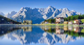
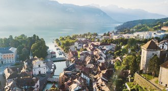
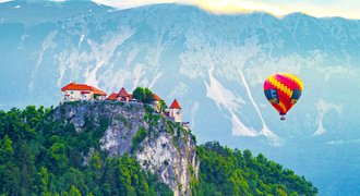
Other beautiful places in Europe
Europe offers loads of natural attractions, including dramatic mountains, picturesque lakes, coastlines, and ancient forests. It's definitely not easy to choose your dream place having so many options.
To find support and inspiration for your travel plans, check out some of the most beautiful places in Europe:
✅ 14 spa towns in Europe to visit if you need relax and rejuvenation
✅ 13 most beautiful mountain resorts in Europe
✅ Adventure honeymoon - 16 best places in Europe
✅ 9 most beautiful hikes in the Balkans

When travelling to Gran Canaria make sure you try a typical Canarian dish called ropa vieja. In America, it's known as a Cuban dish, but it’s actually a byproduct of the Canarian emigration to Cuba in the 18th and 19th century. It's delicious!


