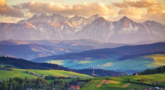
High Tatras are part of Tatra National Park. This scenic National Park is divided between Poland and Slovakia - it's a natural border between those two countries.
Tatra Mountains in Slovakia are higher and cover more area. To learn about more differences between Polish and Slovak Tatras, check out this article.
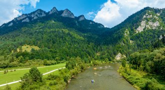
Tatras are one of the best places to visit in Slovakia. Every year, this scenic region is visited by thousands of travellers who want to experience fantastic outdoor adventures and admire breathtaking views. Hikers, trail runners, climbers, skiers - they all love Tatra Mountains.
Only in Slovakia, there are 600 km of trails, loads of chairlifts and gondolas and several beautiful Tatra Mountains resorts.
High Tatras hiking
Interesting facts
Before we start, let's have a look at some interesting facts about this beautiful High Tatras mountain:
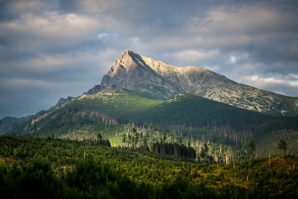
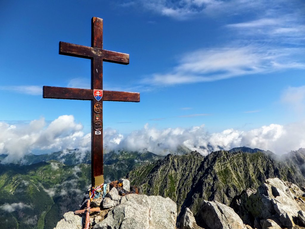
- Kriváň mountain, which reaches 2495 metres, has been a major symbol in Slovak ethnic and national activism.
- A country-wide vote in 2005 selected it to be one of the images on Slovakia's euro coins.
- It's said that every Slovak has to climb Kriváň at least once in his lifetime.
- The name of this mountain comes from the characteristic curvature of its northeast peak.
- Until 1793 Kriváň was considered the highest Tatra mountain (the highest is Gerlachovský štít - 2655 m).
- On August 16th 1841 it was climbed by Ľudovít Štúr and Michal Miloslav Hodža - famous activists of Slovak National Revival. Since then, each year on the third weekend of August many Slovaks climb Kriváň to commemorate the fight for Slovakia's independence. Those patriotic hikes are called národné výlety.
- In 1935 Kriváň was officially named Slovakia's national mountain.
Kriváň - practical info
- Kriváň is part of the High Tatra mountains and, because of its significant height, it may be a bit too much for hikers who have just started their mountain adventures.
- It's a great option if you want to level up and quit the valleys.
- Also, to climb Kriváň you will need to be in good physical condition. The trail gets steep at some points and the ascent is long.
- There is no mountain hut along the trails or on the Kriváň peak. You need to carry food and beverages.
- It belongs to Tatra National Park Slovakia. Entry is free but rescue missions are paid. For more info about TANAP see the section at the bottom of this post.
 Don't miss other valuable Tatra Mountains articles
Tatra Mountains hiking
Kriváň hike description
The best hiking route to Kriváň is the green trail on the west side. It starts at Tri Studničky. The trailhead is on 1140 metres so a lot of elevation is already done. It's the shortest (believe me, doesn't feel so) and the most scenic route.
We also chose that one because there are definitely fewer people than on the red trail leading from Štrbské Pleso.
There's a parking lot near the road in Tri Studničky. It's paid and you'll pay by cash only (costed 5 EUR in 2022).
Despite the fact we arrived very early in the morning (about 4:30 AM), there were already several cars in the parking. Tri Studničky parking isn't very big so it's better to arrive as early in the morning as possible.
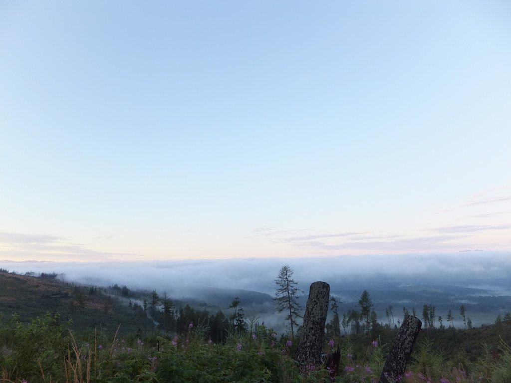
We got up extremely early in the morning. It was still dark by then - we woke up at 3:30 AM to avoid heat and crowds on the trail.
Kriváň is a very popular tourist destination and, in addition, it was August 15th - Assumption of Mary which is a bank holiday in many European countries.
|
|
Length: (only one-way) | 9.32mi (15km) |
|
|
Elevation: (only one-way) | 4659ft (1420m) |
|
|
Time: (only one-way) | 8:30 |
|
|
Remoteness:
|
Average |
|
|
Risks:
|
Average |
|
|
Beauty:
|
9 / 10 |
|
|
Difficulty:
|
7 / 10 |
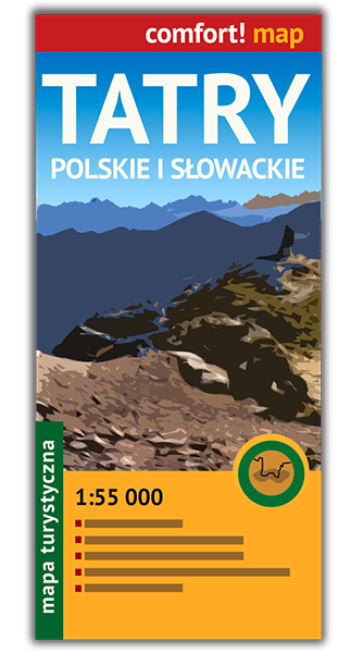
Get a paper Tatra Mountains map.
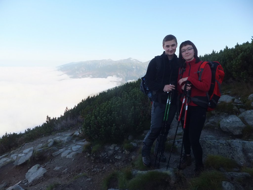
Hiking from Tri Studničky to Kriváň peak took us 4.5 hours (breaks included). It's almost 1400 metres in elevation and 6 kilometres of trail. As you can deduct from these numbers, the route is steep.
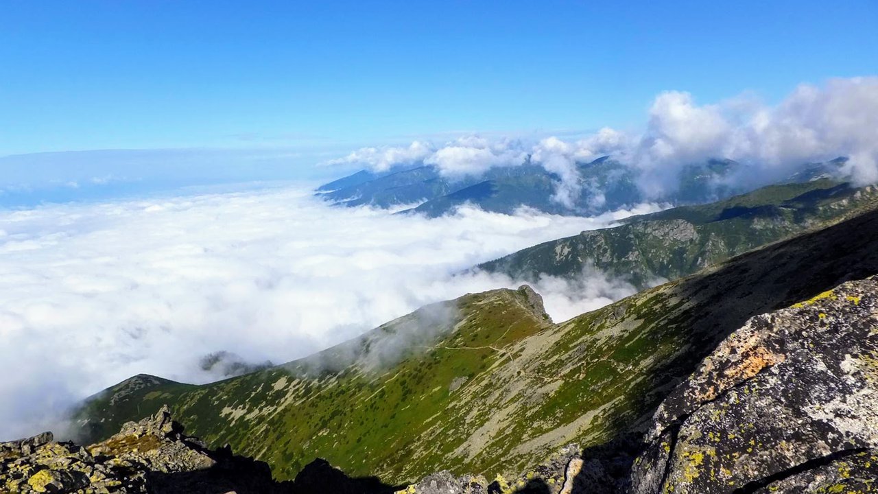
The views were fantastic practically from the beginning. The sun was slowly rising over the morning fog which was forming a white dense carpet as we were climbing up. We were so happy about that - we took a lot of much-needed breaks to catch a breath and admire fabulous views.
The atmospheric conditions were so specific at that time that one of our friends saw a phenomenon called The Brocken Spectre. It's actually your own shadow, cast on mists below you when you are mountain climbing. The shadow may appear enormous and have a ring around it.
Some people believe that when you see the Brocken spectre you will die soon. Our friend is, of course, still alive and enjoys life to the fullest.
While climbing up, we saw a group of chamois and a very fat marmot. Flora and fauna in Tatra Mountains are very abundant and varied. There are many species characteristic of alpine climates.
In Tatra mountains, the levels of vegetation are very distinct. It's called altitudinal zonation, but I just prefer to call it layers of vegetation. 😉 Interestingly, Tatras are part of UNESCO Biosphere Heritage - and we're very happy about that 💚 Such a stunning natural treasure needs to be protected.
OK, let's get back to the trail.

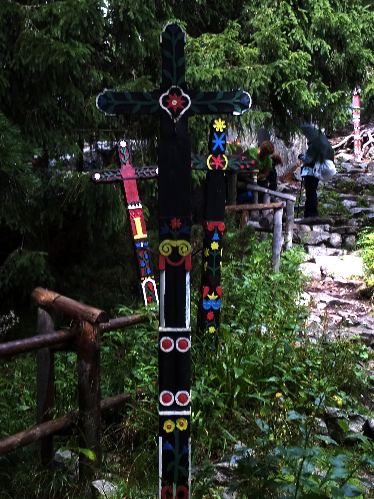
We passed by a place called Grúnik - a memorial which witnessed some bitter fighting between the partizans and the Nazi troops at the end of the Second World War. There's a reconstructed bunker but, unfortunately, we didn't see it from the trail (were we too sleepy?).
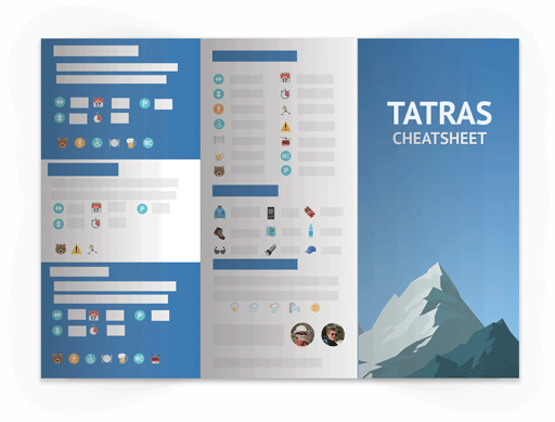
- Download free Tatra Cheatsheet
- View selection of Tatra hotels in Poland or Slovakia on booking.com
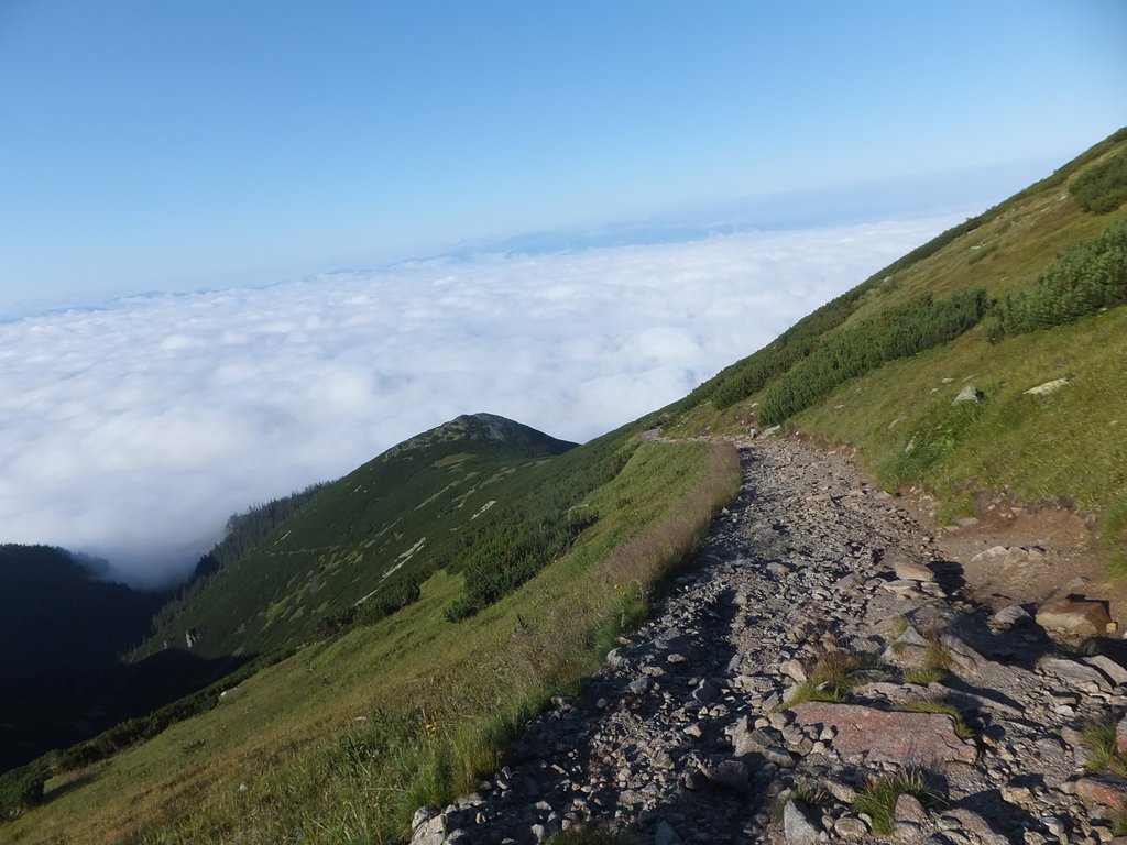
In general, our ascent was very
long but enjoyable hike, the air was cool and humid. we could see in the distance big groups of people approaching the summit - we hiked Kriváň in August and as I mentioned above, this mountain is very popular at this time of year.
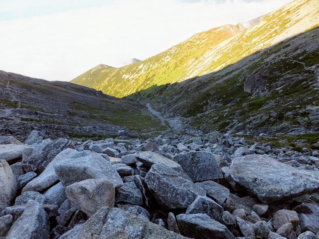
After about 3 hours we arrived at the Krivánsky žľab trail intersection (2120 m). Here, the trail color changes to blue. From this point, there's only one trail leading to Kriváň peak.
The real fun began 😉
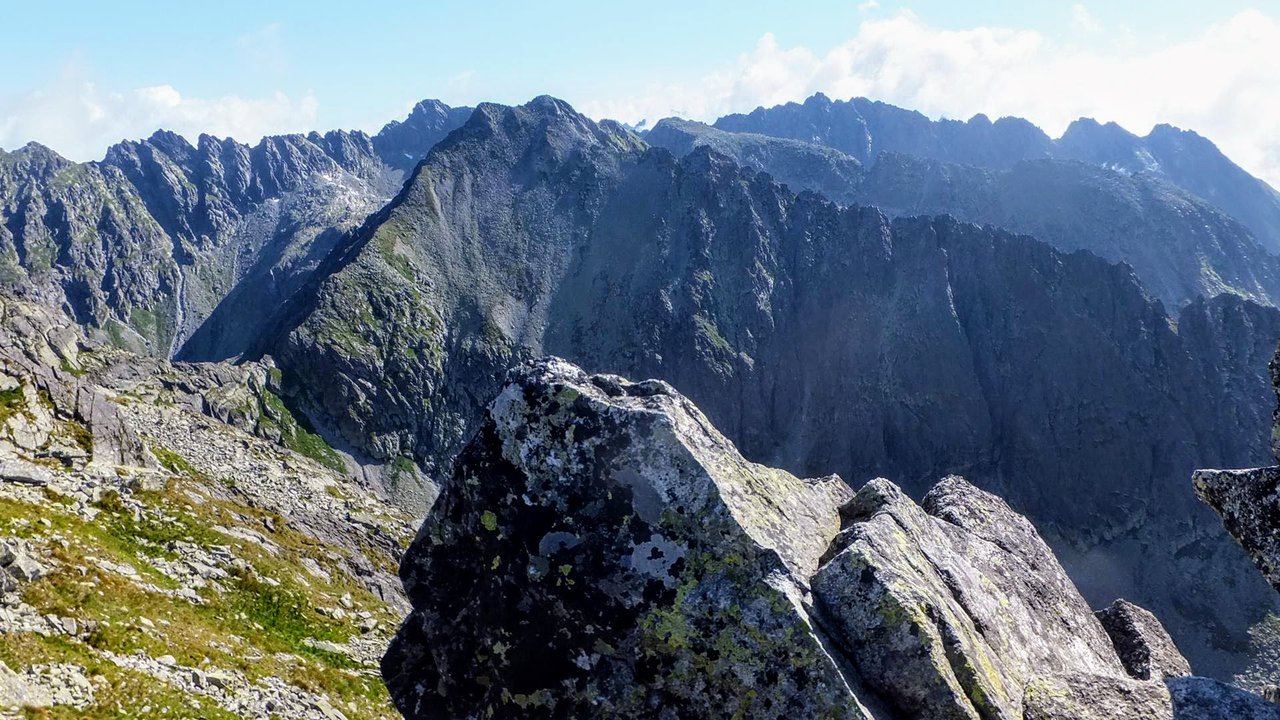
All the vegetation disappeared and the landscape was typically alpine. The trail got rugged and rocky - it was a stone run, a bit tricky to hike at some points.
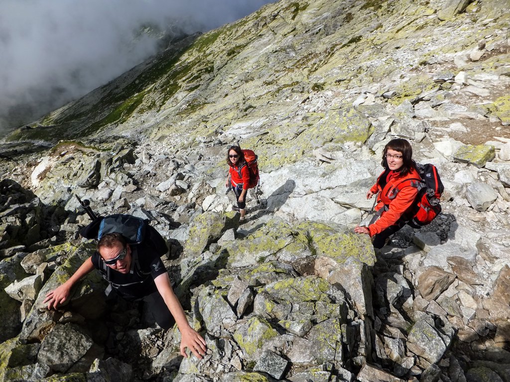

This part of the trail would be technically difficult to climb if the rocks were wet. I advise against hiking Kriváň mountain on a rainy or foggy day.
We were climbing rather slowly as the ascent was quite demanding.
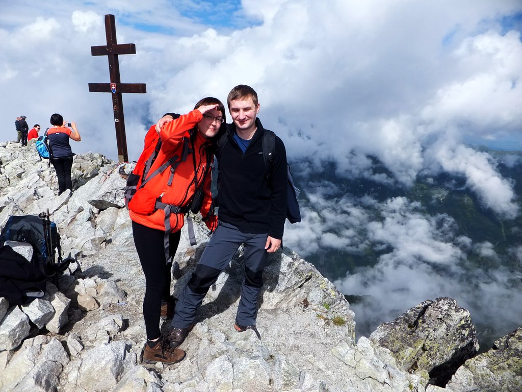
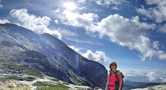
But, at last, we climbed the famous Kriváň peak! We were proud of ourselves.
On the summit, there wasn't too much space. Fortunately, we started hiking so early in the morning that there were only a few other hikers. We could enjoy the breathtaking view of High Tatras in peace. The fabulous mountain landscape rewarded all our efforts.
We had a quick snack and decided to climb down as the sun already started burning our skin.
We hiked down the same route - to Tri Studničky parking.
On our way back we met many hikers and were really happy that we were fortunate to contemplate the beauty of Tatra mountains in peace.
However, after about an hour or two, our happiness was replaced with tiredness and pain. My knees and feet were hurting a lot and all I was thinking of was getting back to the car.
I must admit that it was a demanding trip, no nice and easy few-hour-long walk in the low mountains.
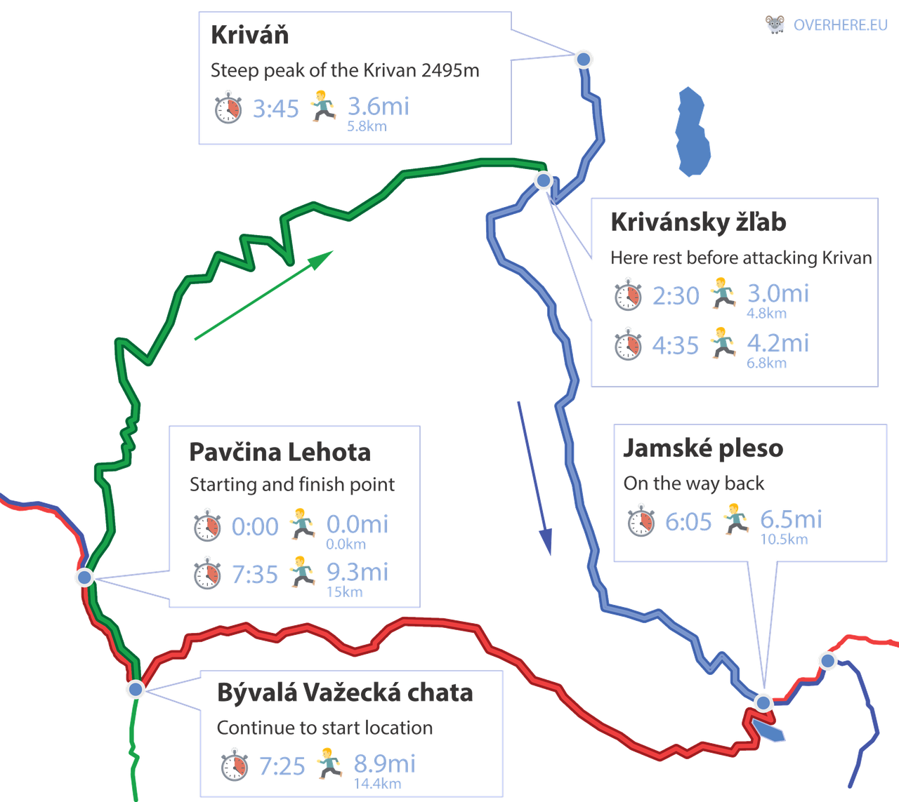
Here’s the timeline of our Kriváň hike:
Tri studničky (Three Springs)
We parked car near the main road no 537. From this road you can enter the trail. Follow green walking route towards north
Distance: 0
Time: 0:00
Altitude: 3740ft (1140m)
Coordinates: 49.139930, 19.966214
Krivánsky žľab (Krivan trough)
After long walk on green path now we are quite close to the peak. We take blue trail that leads uphill.
Distance: 3mi (4.8km)
Time: 2:30
Altitude: 7020ft (2140m)
Coordinates: 49.157471, 19.997692
The Krivan Peak
After very steep uphill hike we reach the peak. We will head back same path we came.
Distance: 3.6mi (5.8km)
Time: 3:45
Altitude: 8185ft (2495m)
Coordinates: 49.162723, 19.999752
Krivánsky žľab (Krivan trough)
We return to the crossing with green path we were before but this time we follow blue trail toward south heading downhill.
Distance: 4.2mi (6.8km)
Time: 4:35
Altitude: 7020ft (2140m)
Coordinates: 49.157471, 19.997692
Jamské pleso
After long decent on blue route we arrive at the Jamske lake. Here we change route to the red one towards south and later west.
Distance: 6.5mi (10.5km)
Time: 6:05
Altitude: 4750ft (1448m)
Coordinates: 49.134209, 20.012594
Bývalá Važecká chata
Now we are very close our starting point. We head green route towards north to reach it.
Distance: 8.9mi (14.4km)
Time: 7:25
Altitude: 3877ft (1182m)
Coordinates: 49.134989, 19.970124
- Download free Tatra Cheatsheet
- View selection of Tatra hotels in Poland or Slovakia on booking.com
Get a paper hiking map of Poland & Slovak Tatra
https://overhere.eu/blog/hiking-map-tatra-mountains/
.Other great hikes in High Tatras
The next day, we wanted to go for a shorter walk as our knees were still aching after a long climb down from Kriváň. We decided to visit a symbolic cemetery in
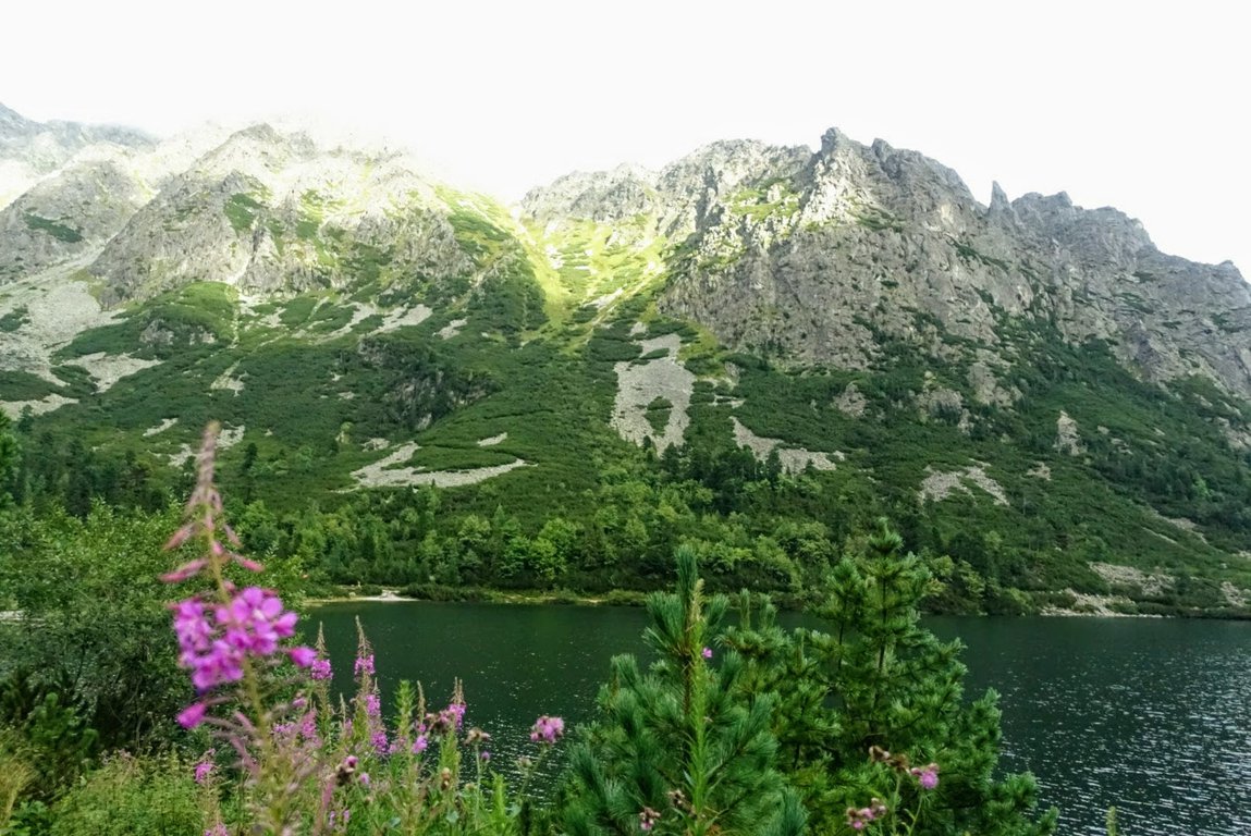
Popradské Pleso
(Poprad Pond) located at 1525 metres.
This symbolic cemetery was built as a memorial dedicated to people who worked and tragically died in the High Tatras.
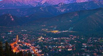
We left our car in the parking right next to Štrbské Pleso lake. This name is used both for the large glacial mountain lake and a beautiful tourist resort in High Tatras Slovakia.
All parking lots near the lake are paid - the higher the parking is located, the more expensive it gets.
We bought 2-hour tickets for Tatranská elektrická železnica - a mountain electric train that runs at the foot of the High Tatra mountains in Slovakia.
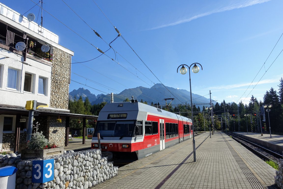
The tram station is located right next to the parking lot at the entrance to Štrbské Pleso. You can check the tram's timetable here.
We traveled to the point where the trail to Popradské Pleso starts - it's just one stop down from Štrbské Pleso.
At first, the trail is just an asphalt road, but a bit higher close to the forest it changes into a proper dirt trail.
Popradské Pleso lake is an awe-inspiring place - I do recommend hiking there.
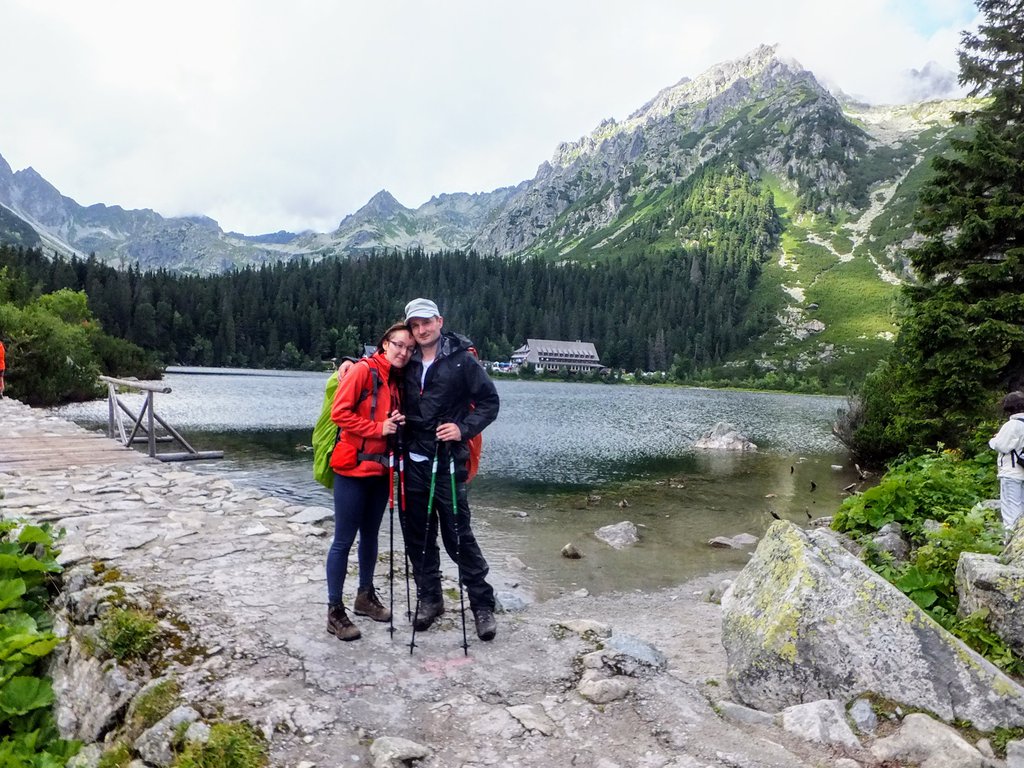
In general, the walk wasn't very demanding - the trail is pleasant, nice and wide. It's a great option for beginners and families with children (as well as tired hikers 😉 ).
Here are some other fantastic options for hiking in High Tatras:
→ Bystra Lavka - exciting hike in Štrbské Pleso
→ Rysy mountain - the highest mountain in Poland
→ The most beautiful hikes in High Tatras
→ Tatranská Lomnica - great base for High Tatras hiking
→ Kościelec - "Polish Matterhorn"
→ 6 easy hikes in High Tatras - suitable also for beginners and families with kids
Slovakia hot springs
OK, there's one more thing besides the Tatra mountains that Slovakia is famous for - waterparks! When you're in Slovakia, you need to visit at least one of those
amazing aquaparks.
On the last day of our trip, we decided to go to Gino Paradise - a thermal park in Bešeňová. You can check the location here. It was fun - there are many water slides, indoor and outdoor pools with hot mineral water, jacuzzis, restaurants, etc. The most interesting area is the adrenaline zone - there's a climbing wall from which you can jump into the pool with high waves.
If you would like to stay close to this water park, you can check available hotels here:
- Download free Tatra Cheatsheet
- View selection of Tatra hotels in Poland or Slovakia on booking.com
Get a paper Tatra Mountains map.
Tatra Mountains resorts
There are many beautiful places to stay in Tatra Mountains. You may check our list of the best Tatra Mountains resorts and choose the best option for you.
If you'd like to find a nice hotel in High Tatras and climb Kriváň, then it's best to stay in Štrbské Pleso.
Here are the highest-rated hotels on booking.com in this fantastic mountain resort:
Grand Hotel Kempinski High Tatras - a 5-star hotel well-known for its comfort and luxury. Many travelers consider it one of the best hotels in Tatra Mountains. Guests value the beautiful wellness centre, tasty and abundant breakfasts and spacious rooms.
APLEND Lake Resort - the perfect option if you'd like to stay in an apartment. There is a wide variety of apartments to choose from. Located just on the lake shore, this hotel is praised for spacious apartments, comfortable beds, friendly staff and underground parking.
Vila Emma - nice budget option. Cozy guest house located within walking distance from the lake. Guests compliment the cleanliness, tasty breakfast and amazing view from the widows.
https://www.booking.com/hotel/sk/vila-emma.en.html?aid=1575106&no_rooms=1&group_adults=2&room1=A%2CA
-
Panoramic Mountain Residence.
Located in Horný Smokovec, part of Vysoké Tatry town. This option is great if you want some comfortable luxury. It's a beautiful place that offers spacious apartments with mountain views. Close to hiking trails. There's no restaurant in this place.
If it seems like a good option for you, you can book your stay here:
Located in Batizovce village. This place is a budget option, but we liked it. The room was nice and clean. Toilets and bathrooms are shared, but they were also clean. Actually, it looked like the rooms and bathrooms were newly refurbished. A big advantage of this place is the restaurant on the ground floor - breakfast costs only 5 EUR, but it's ample and tasty.
You can book your stay here:
Weather in Tatra Mountains
What's worth mentioning is that the day we climbed Kriváň was very sunny. But it was cold in the valley when we started hiking and it was cold and windy on the peak as well.
We recommend getting equipped with good sun protection sunglasses as well as a hat protecting against sunstrokes and easy to carry water supply container for your backpack.
The Tatra mountains, especially the High Tatras, are of alpine characteristics. That means that during one ascent you may experience a few different climates and temperatures. Weather is capricious and can change in the blink of an eye, so it's necessary to take additional windproof and waterproof clothing.
If you'd like to learn more about the weather in Tatra Mountains and prepare well for your mountain trip, have a look at this article.
Tatra National Park Slovakia - practical info
→ Tatra National Park (called TANAP in Slovakia) is a protected area. TANAP has its headquarters in Tatranská Lomnica mountain resort.
→ TANAP is divided into:
- High Tatras - there is the highest mountain in Slovakia - Gerlach (2655 metres)
- Western Tatras - the highest peak is Bystrá (2248 metres)
- Bielskie Tatras - the highest mountain is Havran (2152 metres)
→ Tatra National Park trails in Poland are dense and it is easier to plan a hiking trip. In Slovakia, there are fewer trails. They are also longer, so planning our hike is not so flexible and we cannot change our mind in the middle of the trip. We need to prepare well for our hiking trip.
→ It is not allowed to hike outside officially marked trails. If we want to hike unofficial paths, we need to have a qualified mountain guide with us. Also, we need to inform TANAP authorities about our plans and give a number of hikers and mountain guide's name.
→ All peaks above 2500 metres can be climbed only with a qualified TANAP mountain guide.
→ Tatra National Park trails in Slovakia are closed from November 1st until June 15th.
→ In wintertime, we can only hike to mountain huts in Slovakia (if there is no avalanche risk).
→ Entry to Tatra National Park Slovakia is free of charge, but rescue missions are paid.
→ Tatra mountain rescue in Slovakia is called HZS - Horska Zachranna Sluzba. Emergency number: 18 300.
→ Trail colors do not indicate difficulty, it is just identification.
→ Get a good Tatra Mountains map. Don't rely only on your electronic devices.

